基本情報
出展製品・サービス
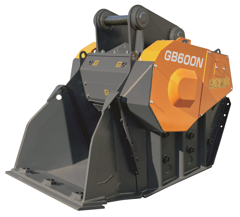
バケットクラッシャ「ガラバスタ®」
バケットクラッシャ「ガラバスタ®」
建設機械、油圧ショベルの先端に取付けてコンクリートガラ等を細かく破砕する機械です。
バケットに本格的なジョークラッシャが内蔵されており、1台で油圧ショベル・自走式クラッシャ・ホイールローダの3役をこなします。
破砕したい大きさ(サイズ)を容易に変更が可能で、隙間のセットを20mm~80mm(機種により20mm~120mm)まで調整ができます。
隙間のセットによっては、自走式クラッシャと同等の処理能力を発揮します。
また、硬い石や鉄のかたまり等の異物を嚙み込んで停止した際は、逆転回転をさせて簡単に異物の除去ができ、すぐに破砕作業を再開させることが可能です。
狭い場所で1人でも破砕作業が可能な利便性の良い「ガラバスタ®」を一度お試しください。

バケット型スクリーン「オシレートスクリーン」
バケット型スクリーン「オシレートスクリーン」
建設機械、油圧ショベルの先端に取付けて土砂等の中の異物等を振るい分ける機械です。
バケット内のスクリーン(アミ)自体が上下に交差運動させてふるい作業を行います。
従来のスケルトンバケットと違いオペレーターのアーム操作による首振りのふるい作業が不要で、振動が少なく静寂性に優れておりオペレーターと建設機械への負担が大幅に軽減されます。マス目は、40×40、50×50、80×80、100×100(単位mm)から選べ、ふるい処理能力にも大変優れており、自走式ふるい機に匹敵します。
スケルトンバケットで振動、騒音の苦情でお困り方、ぜひ使ってみて下さい。
建設機械、油圧ショベルの先端に取付けて土砂等の中の異物等を振るい分ける機械です。
バケット内のスクリーン(アミ)自体が上下に交差運動させてふるい作業を行います。
従来のスケルトンバケットと違いオペレーターのアーム操作による首振りのふるい作業が不要で、振動が少なく静寂性に優れておりオペレーターと建設機械への負担が大幅に軽減されます。マス目は、40×40、50×50、80×80、100×100(単位mm)から選べ、ふるい処理能力にも大変優れており、自走式ふるい機に匹敵します。
スケルトンバケットで振動、騒音の苦情でお困り方、ぜひ使ってみて下さい。

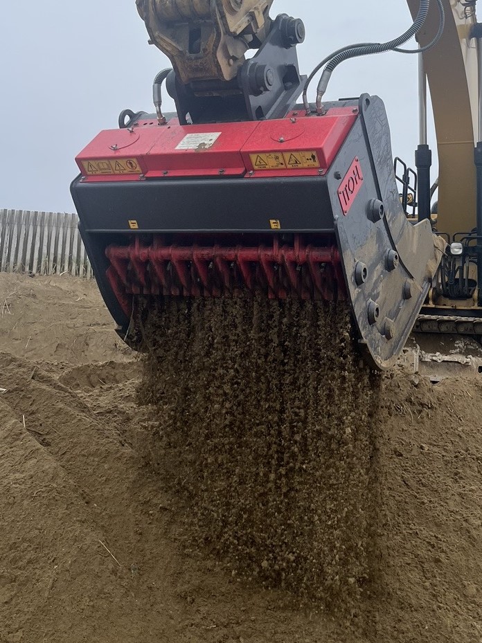
スクリーニングバケット「マッドファイター®」
スクリーニングバケット「マッドファイター®」
建設機械、油圧ショベルの先端に取付けて土等の中の異物等をふるい分ける機械です。
ブレード(刃)の形状を2種類用意、サイズは15mm、30mm、50mmと設定があり、比較的細かい細粒ふるいに適しており、ふるい対象物によってブレードを選択可能です。
この多くのブレードを回転させて強制的に土と異物を分別するので、多少粘着性が高く、湿潤度の高い土でもふるい作業を行うことが出来ます。
土、砂、泥の細粒ふるいや土壌改良などに最適なスクリーニングバケットもおすすめです。
建設機械、油圧ショベルの先端に取付けて土等の中の異物等をふるい分ける機械です。
ブレード(刃)の形状を2種類用意、サイズは15mm、30mm、50mmと設定があり、比較的細かい細粒ふるいに適しており、ふるい対象物によってブレードを選択可能です。
この多くのブレードを回転させて強制的に土と異物を分別するので、多少粘着性が高く、湿潤度の高い土でもふるい作業を行うことが出来ます。
土、砂、泥の細粒ふるいや土壌改良などに最適なスクリーニングバケットもおすすめです。
