基本情報
We develop and deliver innovative technologies that achieve high quality, low cost, and easy operation, accelerating the democratization of 3D data utilization at jobsites.
出展製品・サービス
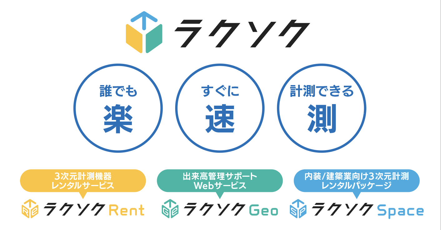
ラクソクシリーズ
RAKUSOKU series
誰でも、すぐに現場を3D計測。
「ラクソク」は、計測の専門家でなくても現場を簡単に計測できることをコンセプトに株式会社FLIGHTSが開発したサービスシリーズです。
“誰でも(楽)・すぐに(速)・計測できる(測)”を実現するため、レーザースキャナーや写真測量の技術と現場ノウハウを組み合わせ、現場の距離・面積・土量などを簡単に把握できる計測ソリューションを提供します。
本展示では、現場計測からデータ活用までを支援する以下の3サービスをご紹介します。
■ ラクソクRent
高性能ハンディレーザースキャナーと解析ソフトや端末機器など、スキャンからデータ活用までに必要な機材やソフトをオールインワンでレンタル提供。建設コンサルタント様の現地踏査や建設会社様の施工確認・出来形確認などに幅広くご活用いただけます。
■ ラクソクGeo
ドローン写真測量やレーザースキャナーデータを活用し、日々の施工量(切土・盛土)や仮置き土量の変化を定量管理。出来高の可視化や出来高報告書の自動作成を実現します。
■ ラクソクSpace
ハンディスキャナーで取得した屋内データから3Dモデルを生成し、天井高や床・壁面積などを簡単に計測。改修前調査や施工管理に活用できます。
3D Site Measurement for Everyone — Instantly.
“RAKUSOKU” is a service series developed by FLIGHTS Inc. based on the concept that site measurement should be simple and accessible even for non-specialists.
To realize “Easy (Raku), Fast (Soku), and Accurate Measurement (Soku),” the solution integrates laser scanning and photogrammetry technologies with practical field expertise, enabling users to quickly grasp distances, areas, and earthwork volumes on site.
At this exhibition, we introduce the following three services that support the entire workflow from on-site measurement to data utilization.
■ RAKUSOKU Rent
An all-in-one rental package providing high-performance handheld laser scanners, analysis software, and terminal devices required for the entire workflow from scanning to data utilization.
It can be widely used for on-site inspections by engineering consultants, as well as for construction progress verification and as-built confirmation by contractors.
■ RAKUSOKU Geo
Utilizes drone photogrammetry and laser-scanning data to quantitatively manage daily earthwork volumes (cut and fill) and changes in temporary stockpile volumes.
It enables visualization of construction progress and automatic generation of progress reports.
■ RAKUSOKU Space
Generates 3D models from indoor data captured with handheld scanners, allowing easy measurement of ceiling heights, floor areas, wall surfaces, and more.
It can be effectively used for pre-renovation surveys and construction management.
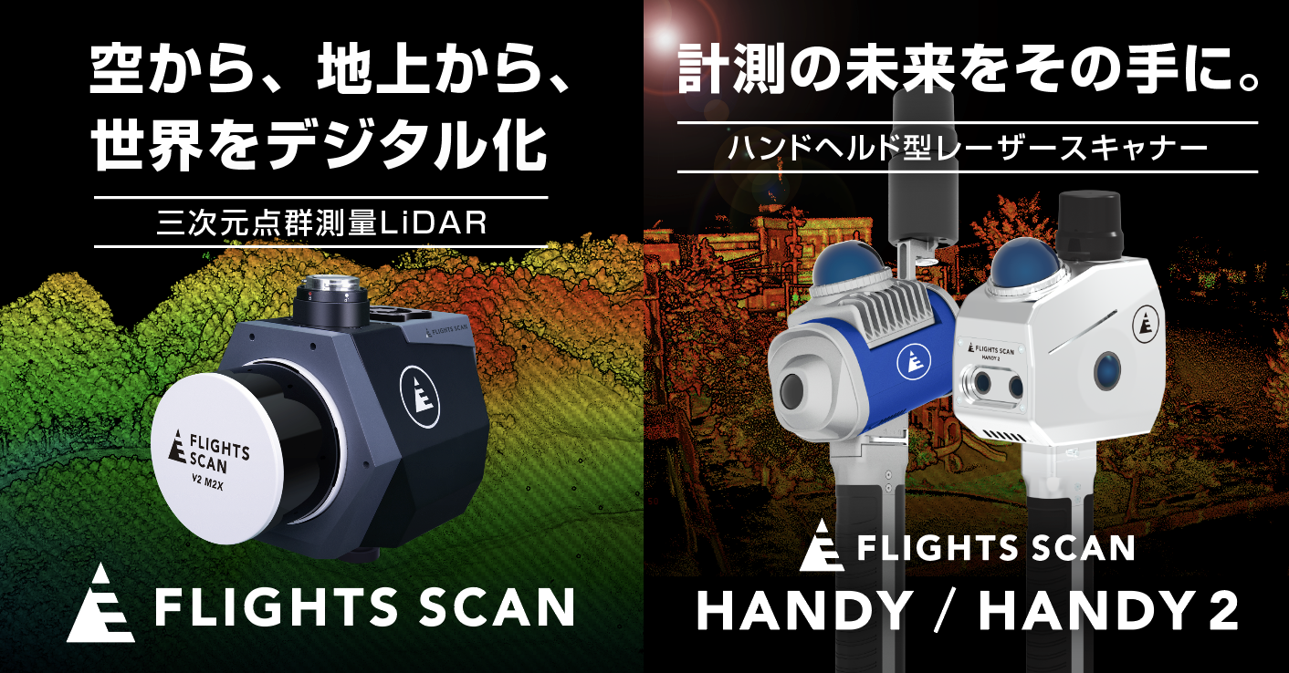
FLIGHTS SCANシリーズ(UAV&Handy)
FLIGHTS SCAN series(UAV&Handy)
FLIGHTS SCANシリーズは公共測量に活用できる高精度な三次元点群測量LiDARです。UAV搭載型の「FLIGHTS SCAN」とハンドヘルド型レーザースキャナー「FLIGHTS SCAN Handy」を展開しています。
■「FLIGHTS SCAN」
UAV(ドローン)に搭載し、広域計測を可能にす三次元点群測量LiDARです。
森林や山間部、河川、道路などの広域エリアを効率的に計測でき、地形測量やインフラ調査などで
レーザー計測により植生下の地形取得にも対応し、短時間で広範囲の高密度点群データを取得できることが特長です。
また、FLIGHTS SCANと合わせて、「FLIGHTS SCAN Suite」という形で、地形追従飛行計画作成Webサービス「FLIGHTS PLAN」、点群作成ソフト「FLIGHTS POINT」、
成果品作成Webサービス「FLIGHTS DOCS」もご用意しております。
これにより、従来の測量手法では多くの時間と人手を要していた地形取得作業の大幅な工数削減が期待できます。
■「FLIGHTS SCAN Handy」
SLAM(Simultaneous Localization and Mapping)技術を活用したハンドヘルド型レーザースキャナーです。
歩行しながら計測することで、橋梁下部、トンネル内部、建設現場、屋内空間など、ドローンの飛行が難しい環境でも高密度な3次元点群データを取得できます。
GPSが利用できない環境でも自己位置推定により計測が可能で、短時間で構造物や空間を高精度に記録することができます。
FLIGHTS SCAN series is a high-precision 3D LiDAR solution designed for public surveying applications.
The lineup includes the UAV-mounted “FLIGHTS SCAN” and the handheld laser scanner “FLIGHTS SCAN Handy.”
■ FLIGHTS SCAN
FLIGHTS SCAN is a UAV-mounted LiDAR system that enables efficient wide-area surveying and 3D point-cloud data acquisition.
It is suitable for surveying large-scale environments such as forests, mountainous regions, rivers, and road corridors, supporting applications including topographic surveys and infrastructure investigations.
By utilizing laser measurement technology, the system can capture ground surface data beneath vegetation, allowing high-density point-cloud data to be collected across extensive areas in a short period of time.
In addition, FLIGHTS offers the “FLIGHTS SCAN Suite,” a comprehensive workflow solution that includes:
FLIGHTS PLAN: a web-based flight planning service with terrain-following capability
FLIGHTS POINT: point-cloud processing software
FLIGHTS DOCS: a web service for generating survey deliverables
Together, these solutions significantly reduce the time and labor traditionally required for terrain data acquisition using conventional surveying methods.
■ FLIGHTS SCAN Handy
FLIGHTS SCAN Handy is a handheld laser scanner that utilizes SLAM (Simultaneous Localization and Mapping) technology.
By enabling data capture while walking, it allows users to efficiently acquire high-density 3D point-cloud data in environments where drone operation is difficult, such as bridge substructures, tunnels, construction sites, and indoor spaces.
Even in GPS-denied environments, the system performs measurement through real-time self-localization, enabling accurate and rapid recording of structures and spatial environments
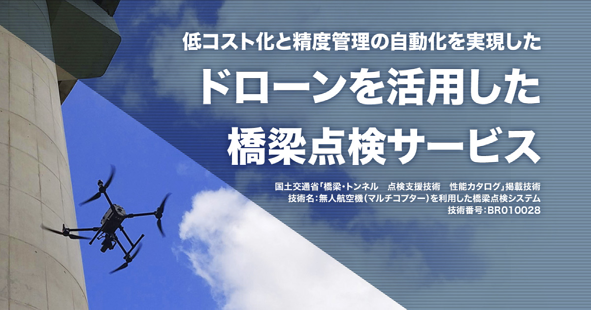
FLIGHTS橋梁点検システム
FLIGHTS Bridge Inspection System
「FLIGHTS 橋梁点検システム」は、ドローン技術と独自開発のソフトウェアを組み合わせ、老朽化が進むインフラ点検の課題(人手不足・コスト増)を解決する点検支援サービスです。
国土交通省の「橋梁・トンネル 点検支援技術 性能カタログ 」にも掲載されており、橋梁定期点検時の近接目視の代替としてご活用いただいております。
(技術名:無人航空機(マルチコプター)を利用した橋梁点検システム、技術番号:BR010028)
最大の特長は、下部工などのGPSが届かない(非GNSS)環境下でも、安定した「自動飛行撮影」が可能な点です。
操縦者の高い操縦技術が必要な「常に対象物と一定の距離かつ正対しての撮影」を、機体に搭載されたビジョンセンサー、気圧計などの測距値を基に、弊社が独自開発した自動飛行アプリ「FLIGHTS CONTROL」により機体を制御、自動飛行撮影することで、均一で高品質な画像を撮影できます。
撮影画像は現場で即座に「精度管理アプリ」で品質確認でき、撮り直しの手戻りを防ぎます。
内業では独自に開発した現像アプリや画像合成処理によりボケや歪みのない高解像度オルソモザイクを作成し、最適化されたAIが0.1mm単位のひび割れを高精度に自動で検出・計測します。
これにより、従来橋梁点検車やロープアクセスが必要だった定期点検において、近接目視の代替として撮影から損傷図作成までをリーズナブルに安全かつ効率よく点検することが可能です。
本システムは、すでに橋梁の定期点検として440基以上の実績があり、多くの現場でご活用いただいております。
2025年4月からはPCラーメン箱桁橋や中空床板桁橋の上部工にも対応し、点検業務の効率化を強力にバックアップします。
FLIGHTS Bridge Inspection System is an inspection support service that combines drone technology with proprietary software to address challenges in aging infrastructure inspection, such as labor shortages and rising costs.
The system is listed in the Ministry of Land, Infrastructure, Transport and Tourism’s Performance Catalog of Inspection Support Technologies for Bridges and Tunnels, and is utilized as an alternative method to close visual inspection during routine bridge inspections.
(Technology name: Bridge inspection system using unmanned aerial vehicles (multicopters), Technology No.: BR010028)
One of its key features is the ability to perform stable automated flight-based image capture even in non-GNSS environments, such as substructures where GPS signals are unavailable.
Capturing images while maintaining a constant distance from and orientation toward the target—typically requiring advanced piloting skills—is automated by the proprietary flight control application “FLIGHTS CONTROL.” By controlling the aircraft based on distance measurements obtained from onboard vision sensors and barometric data, the system enables consistent, high-quality image acquisition.
Captured images can be immediately checked on site using the accuracy management application, preventing rework due to insufficient image quality.
For office processing, a proprietary image processing application and image compositing technology generate high-resolution orthomosaics without blur or distortion. An optimized AI system then automatically detects and measures cracks with high precision at a resolution of 0.1 mm.
This enables safe, efficient, and cost-effective inspections—from image capture to damage mapping—serving as an alternative to conventional methods that require bridge inspection vehicles or rope access.