基本情報
出展製品・サービス
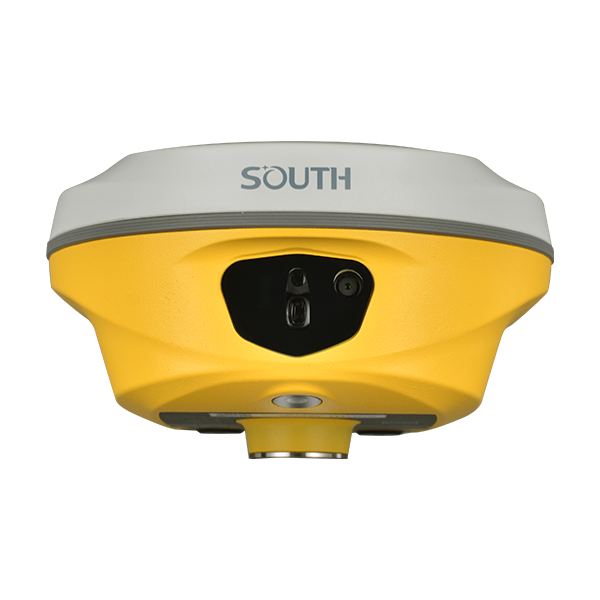
光波距離計・トータルステーション・RTK 機器
Conventional Total Stations & RTK Equipment
1989 年より世界測量業界のパイオニアとして、南方測量(SOUTH)は世界中で743,600 台以上のトータルステーションと 528,000 台以上の GNSS 受信機を供給してまいりました。豊富で充実した製品ラインアップを有し、堅牢な現場稼働性能により、お客様の作業効率を最大限に高めることを支援します。
As a pioneer in the global survey industry since 1989, SOUTH has delivered 743,600+ total stations and 528,000+ GNSS receivers worldwide. We offer a complete and comprehensive product portfolio, and with our robust field performance, we help you maximize operational efficiency.
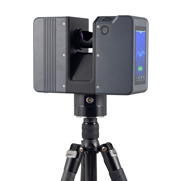
レーザーレーダー(LiDAR)機器
LiDAR Equipment
長年の光機電技術の蓄積を活かし、南方測量は TLS(地上型レーザースキャナ)、航空機載レーザーレーダー、SLAM 方式ハンドヘルドスキャナまで、完全自社開発の LiDAR 製品をフルラインアップで提供しています。高速・高精度な 3D スキャンにより、デジタル測量、3D モデリング、インフラ点検、スマート建設などの現場で信頼性の高い点群データを提供します。
Leveraging years of expertise in opto‑mechatronic technologies, SOUTH offers a complete lineup of fully self‑developed LiDAR products, including terrestrial laser scanners (TLS), airborne LiDAR systems and SLAM‑based handheld scanners. These high‑speed, high‑accuracy 3D scanning solutions deliver reliable point cloud data for digital surveying, 3D modeling, infrastructure inspection and smart construction.
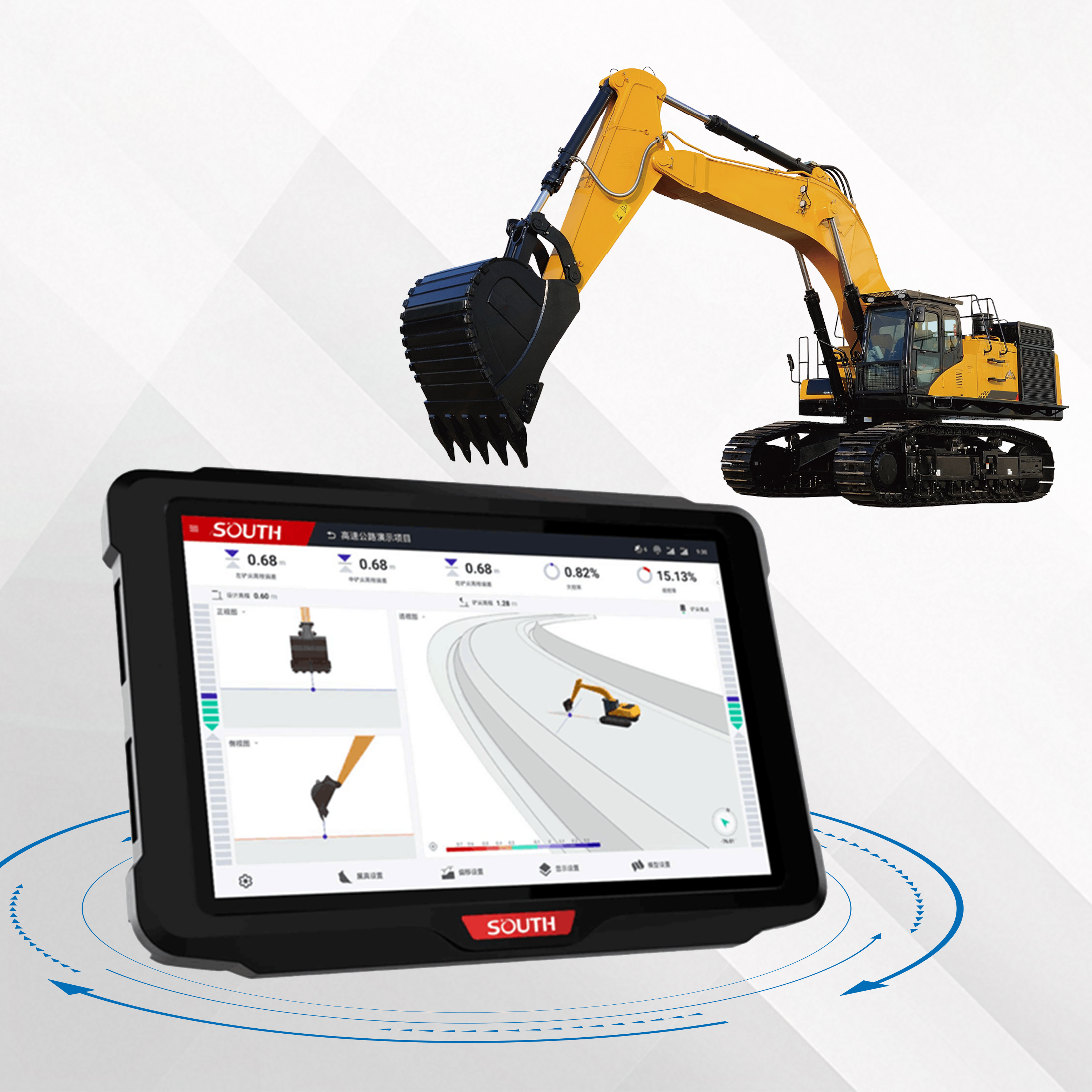
機械制御システム
Machine Control Systems
南方測量のインテリジェント 3D 機械制御システムは、GNSS 高精度測位とマルチセンサー融合技術を基盤に開発されています。測量データと設計データを統合し、センチメートル級の精度でリアルタイムな施工誘導を実現。施工品質・効率・生産性を大幅に向上させ、コストと手戻りを削減します。
SOUTH intelligent 3D machine control systems are built on GNSS high‑precision positioning and multi‑sensor fusion technology. Integrating survey and design data, the system provides real‑time construction guidance with centimeter‑level accuracy. It significantly enhances construction quality, efficiency and productivity while reducing costs and rework.