基本情報
*Based on our research
出展製品・サービス
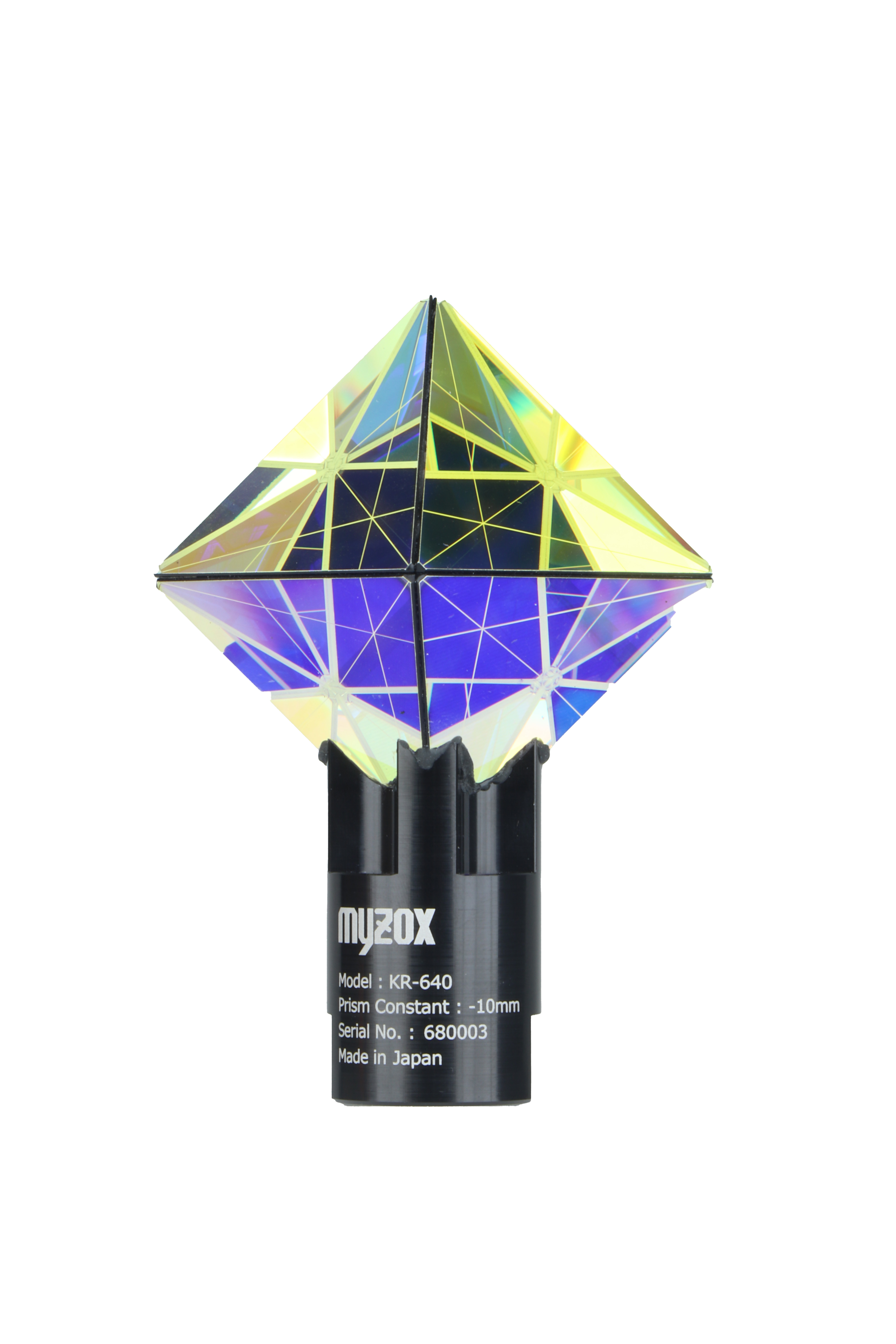
自動追尾用3Dプリズム KIRA640
3D Tracking Prism KIRA640
自動追尾用3Dプリズム「KIRA640」は、建設・土木測量の作業効率向上を目的に開発された全方位型マシンガイダンス用プリズムです。8つのプリズムをダイヤモンド形状に配置する独自構造により、水平360度・垂直280度の広い反射角を実現。従来の360°プリズムでは対応が難しかった上下方向からの追尾にも対応し、測量機やマシンガイダンスシステムによる安定した自動追尾を可能にします。建設機械の稼働中でも高い視準性を確保し、機械施工の精度向上と測量作業の効率化に貢献します。現場での設置自由度も高く、次世代のICT施工を支える新しいプリズムです。
Auto-Tracking 3D Prism “KIRA640” is an omni-directional machine guidance prism developed to improve efficiency in construction and civil engineering surveying. Its unique structure features eight prisms arranged in a diamond configuration, achieving a wide reflective range of 360° horizontally and 280° vertically.
Unlike conventional 360° prisms that mainly reflect signals in the horizontal direction, KIRA640 enables reliable tracking even from vertical angles. This allows total stations and machine guidance systems to maintain stable auto-tracking.
Even during machine operation on construction sites, the prism ensures high visibility and stable targeting, contributing to improved machine control accuracy and more efficient surveying work. With flexible installation options on site, KIRA640 is designed to support the next generation of ICT-based construction and machine guidance applications.
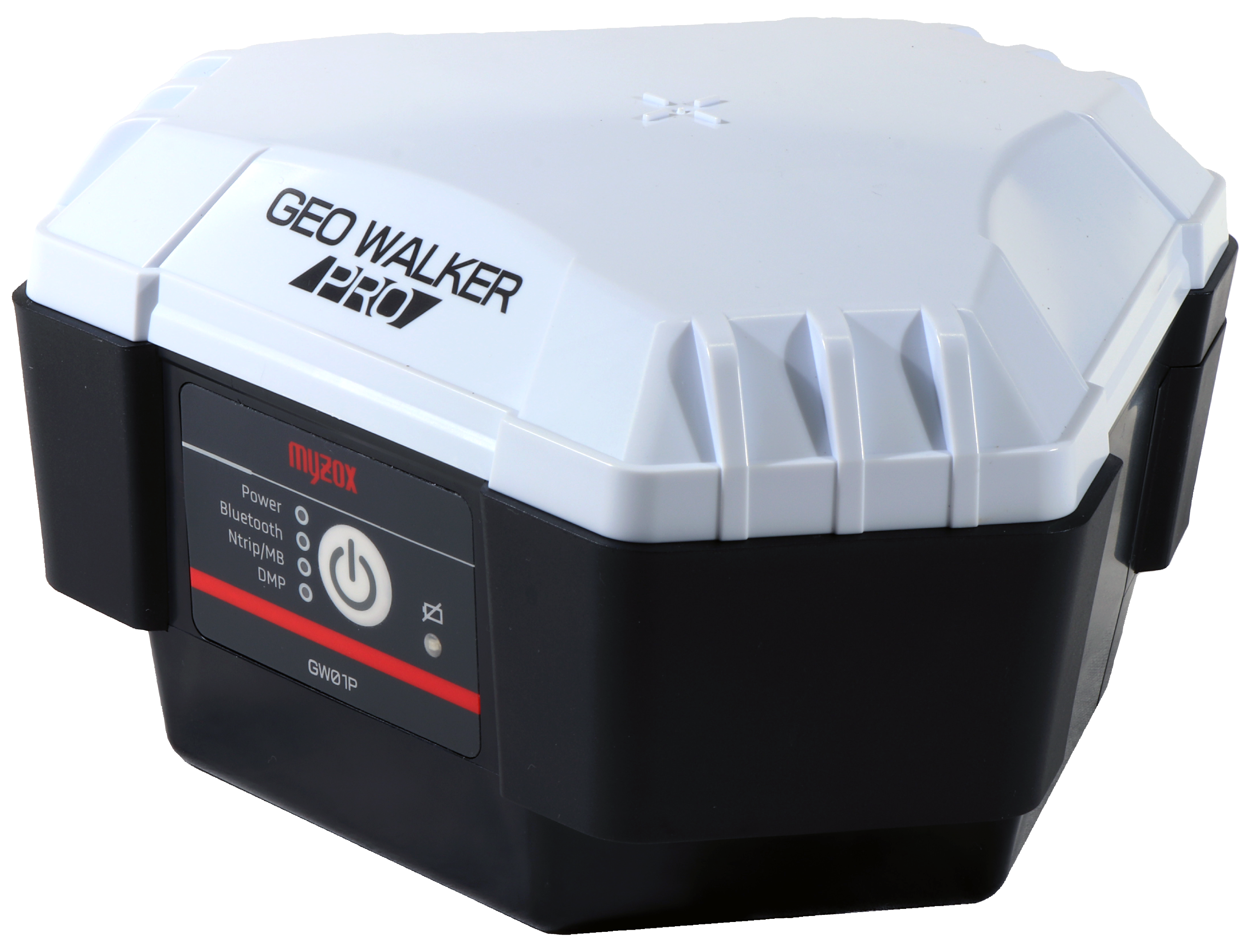
2周波RTK-GNSS受信機 GEO WALKER PRO
Dual-frequency RTK GNSS Receiver GEO WALKER PRO
GEO WALKER PROは、「誰でも使える、ツール感覚のGNSS 測量機」をコンセプトに開発された日本製のGNSS測量機です。国土地理院1級登録、充実した機能に加え、初めて購入される方にとってお求めやすい価格を実現。ご購入後も安心してお使いいただけるよう、手厚いサポートサービスを整えています。 GNSS技術を活用し、誤差を最小限に抑えたリアルタイム測位を可能とし、迅速なデータ取得と安定した測定により、現場の生産性を大幅に向上させます。複雑な地形や厳しい環境下でも確実な測位を実現し、測量業務の効率化をサポートします。
GEO WALKER PRO is a GNSS surveying system made in Japan, developed under the concept of “a GNSS surveying tool that anyone can use.” It is registered as a Class-1 instrument with the Geospatial Information Authority of Japan (GSI) and offers a full range of functions while maintaining an affordable price, making it ideal for first-time users. In addition, comprehensive support services are provided to ensure reliable use even after purchase.
By utilizing advanced GNSS technology, GEO WALKER PRO enables real-time positioning with minimal error, allowing for rapid data acquisition and stable measurements. This significantly improves productivity at surveying and construction sites. Even in complex terrain or harsh environments, it delivers reliable positioning performance, helping to streamline and enhance the efficiency of surveying operations.
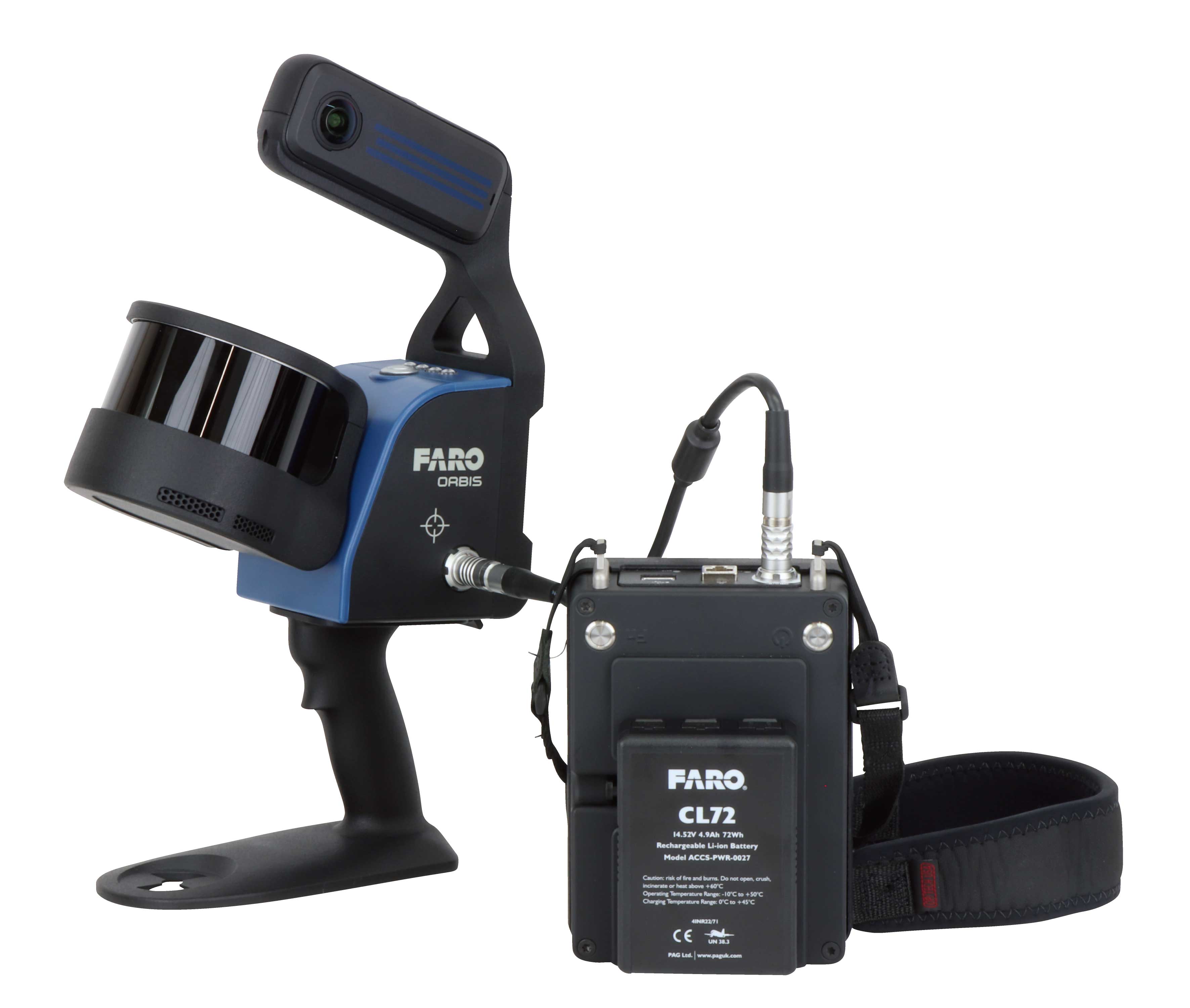
モバイルレーザースキャナOrbis™ Premium
Mobile Laser Scanner Orbis™ Premium
FARO社製モバイルレーザースキャナOrbis™ Premium 1秒あたり64万点照射の高性能レーザースキャナと最大7200万画素の高解像度360度カメラを搭載し、3Dデータとパノラマ画像の両方を取得可能です。さらに、スキャナは防塵・防滴性能IP54で、厳しい環境でも優れたパフォーマンスを発揮する堅牢性を備えています。
・端面もくっきり計測
・フラッシュスキャンでより密な点群取得
・オープンループでの計測が可能
The FARO mobile laser scanner Orbis™ Premium is equipped with a high-performance laser scanner capable of capturing 640,000 points per second, along with a high-resolution 360° camera of up to 72 megapixels, enabling simultaneous acquisition of both detailed 3D point cloud data and panoramic images.
The scanner is designed with IP54 dust- and water-resistant protection, providing the durability required to maintain excellent performance even in demanding environments.
Key Features:
Clearly captures edges and end surfaces with high accuracy
Flash Scan technology enables denser point cloud acquisition
Supports open-loop scanning, allowing flexible data capture in a wide range of environments