基本情報
出展製品・サービス
3D for Everyone 「3DならSketchUp」
3D is for everyone. “For 3D, choose SketchUp.”
建設・土木コンサルタントの計画業務では、図面だけでは完成イメージが伝わりにくく、発注者や地域住民との合意形成に時間がかかるという課題があります。
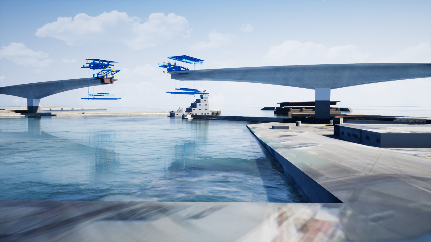
SketchUpは、道路・橋梁・造成・構造物などの計画を短時間で3Dモデル化できる直感的なモデリングソフトです。CAD図面を取り込み、地形や構造物をその場で立体化できるため、設計初期の検討や景観確認をスピーディーに進めることができます。
さらに、点群データや地形情報を活用した現況モデルの作成にも対応し、現場条件を反映した計画検討が可能です。作成した3Dモデルは、景観検討、施工イメージ共有、住民説明資料など幅広い用途で活用でき、プロジェクトの理解度向上と意思決定の迅速化に貢献します。
アルファコックスでは、建設コンサルタントや測量会社の実務で活用できるSketchUpの運用ノウハウを提供しています。
展示ブースでは、点群・地形データを活用した土木モデル作成や、計画検討を効率化する3Dワークフローを実演します。ぜひ実際の操作をご覧ください。
In the planning phase of construction and civil engineering consulting, there is a challenge in that drawings alone often fail to convey a clear vision of the finished project, leading to delays in reaching consensus with clients and local residents.
SketchUp is an intuitive modeling software that allows you to quickly create 3D models of plans for roads, bridges, land development, and structures. By importing CAD drawings and instantly converting terrain and structures into 3D models, you can expedite initial design reviews and landscape assessments.
Furthermore, it supports the creation of as-built models using point cloud data and topographic information, enabling planning studies that reflect actual site conditions. The created 3D models can be utilized for a wide range of purposes, including landscape assessments, sharing construction visualizations, and materials for community briefings, thereby contributing to improved project understanding and faster decision-making.
At AlphaCox, we provide operational know-how for SketchUp that can be applied in the day-to-day work of construction consultants and surveying firms.
At our exhibition booth, we will demonstrate civil engineering model creation using point cloud and terrain data, as well as 3D workflows that streamline planning studies. We invite you to see these demonstrations in action.
デジタルツインで変わるインフラ計画の可視化「Twinmiton」
“Twinmiton”: Transforming Infrastructure Planning Visualization with Digital Twins
インフラ計画や土木設計では、計画内容を発注者や地域住民にわかりやすく伝えることが求められます。しかし図面や静止CGだけでは空間イメージが伝わりにくく、説明に時間がかかるケースも少なくありません。
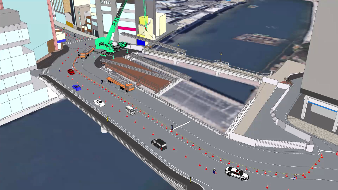
Twinmotionは、設計データをリアルタイムで高品質なビジュアルへ変換できる3Dビジュアライゼーションソフトです。SketchUpなどの3Dモデルを取り込み、道路・橋梁・造成・都市景観などを短時間でリアルな空間として表現できます。
太陽光の変化、植栽、交通、人の動きなどを簡単に追加できるため、景観検討や環境検討、住民説明資料の作成に最適です。さらに、リアルタイムレンダリングにより設計変更をその場で反映できるため、発注者との打ち合わせや計画検討を効率的に進めることができます。
アルファコックスでは、SketchUpや他BIM/CIMCADとTwinmotionを組み合わせた建設コンサル向けの可視化ワークフローを提案しています。
展示ブースでは、3Dモデルからリアルな景観映像を短時間で作成するデモをご覧いただけます。
In infrastructure planning and civil engineering design, it is essential to communicate project details clearly to clients and local residents. However, drawings and static CG images alone often fail to convey a sense of space, and explanations can frequently take a long time.
Twinmotion is 3D visualization software that converts design data into high-quality visuals in real time. By importing 3D models from programs such as SketchUp, it allows you to quickly render roads, bridges, land development, and urban landscapes as realistic 3D environments.
Since elements such as changes in sunlight, vegetation, traffic, and pedestrian movement can be easily added, it is ideal for landscape and environmental studies, as well as for creating presentation materials for residents. Furthermore, real-time rendering allows design changes to be reflected on the spot, enabling efficient meetings with clients and planning discussions.
At Alphacox, we propose visualization workflows for construction consultants that combine SketchUp and other BIM/CIM CAD software with Twinmotion.
At our exhibition booth, you can watch a demonstration of how to quickly create realistic landscape videos from 3D models.