基本情報
出展製品・サービス
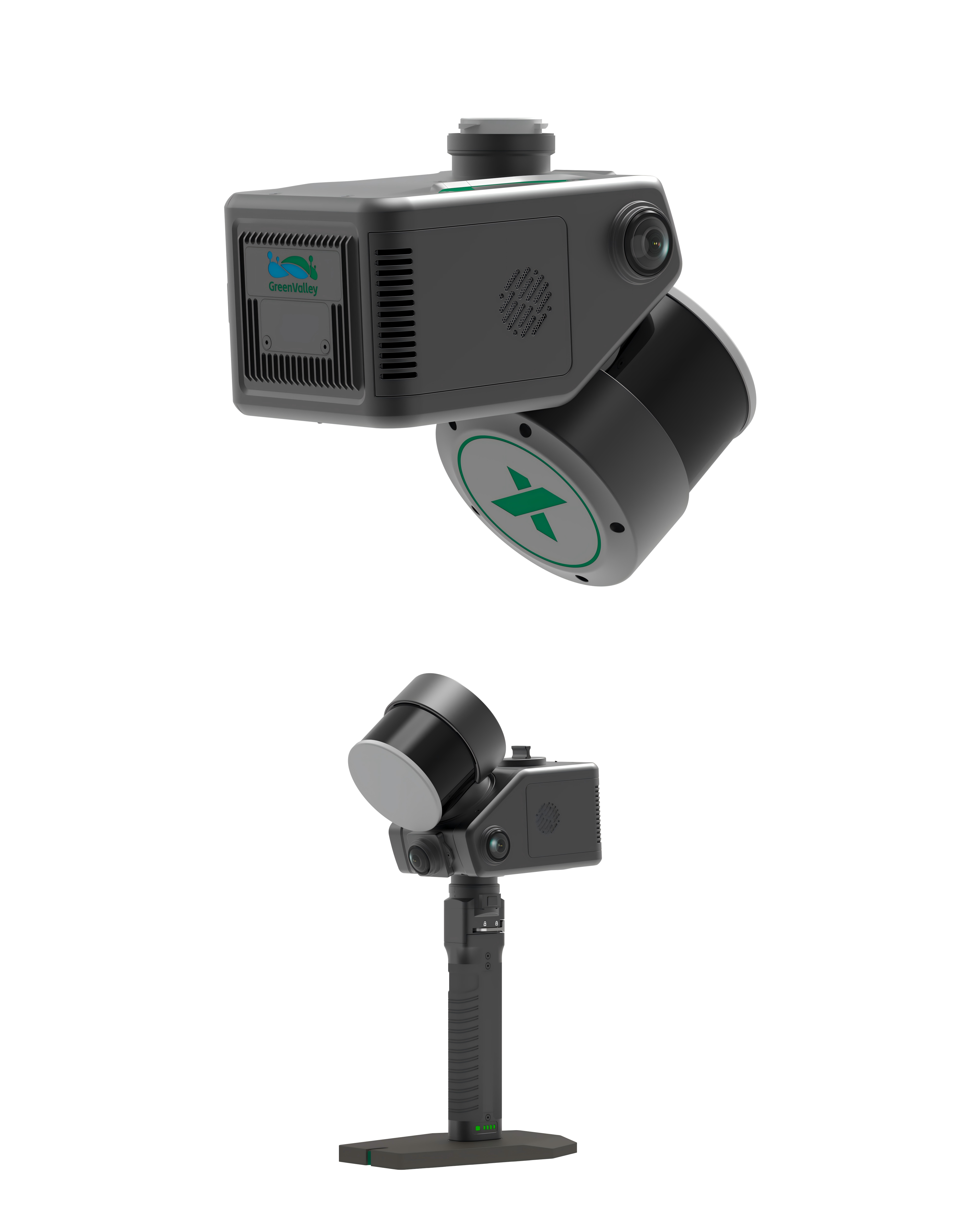
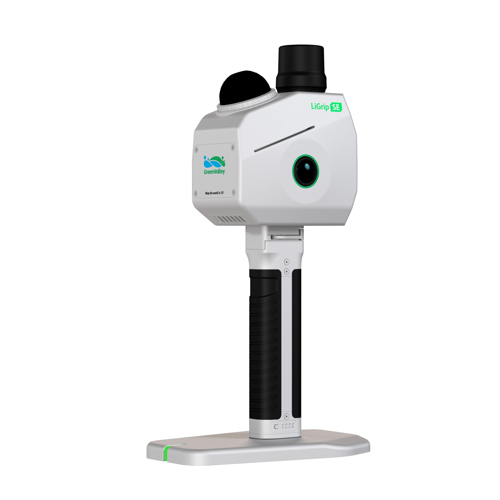
LiGrip SE
LiGrip SE
LiGrip SEは、高品質でありながら手頃な価格を実現した信頼性の高い軽量ハンディ型レーザースキャナーです。ダブル1200万画素高精細魚眼カメラを標準装備し、GVI独自の最新測量級SLAMアルゴリズムにより、再処理不要の高精度データを即座に提供。従来の高価格帯製品と同等の性能を、優れたコストパフォーマンスで実現し、LiDAR360MLSとの連携で日常的な操作の利便性と即時処理を可能にする、現代のモバイルマッピングに最適なソリューションです。
過酷な環境下での野外測量・点検作業に適しており、バックパックキット、フロントパックキット、伸縮ポールキット、ロボットドッグ搭載など、多様な展開モードで柔軟なデータ収集を可能にします。専有の測量級SLAM技術は鉱山・林業・商業施設などの複雑環境でもオープンソースアルゴリズムを凌駕し、IP54保護等級の防塵防水性能により雨・雪・粉塵環境下でも安定動作を維持。ハンディ使用時の相対精度2cm以内、絶対精度5cm以内を実現する、コスト対効果の高い計測ソリューションです。
Mid360レーザーを搭載し、最大秒間20万ポイントの高速スキャンを実現。高い携帯性を備え、標準SEモデルは1.33kg、強化型SE RTKモデルでも1.38kgの軽量設計でありながら、従来の高価格機種に引けを取らない性能をリーズナブルな価格で提供します。プロフェッショナル向けの本格性能と優れた価格設定で、幅広いユーザーに本格的な3D計測技術を手の届くものとしています。
The LiGrip SE is a lightweight handheld laser scanner. Designed from the ground up to be your reliable partner for scanning tasks, the LiGrip SE is fully equipped with dual 12 MP high definition fisheye cameras. It utilizes the absolute latest generation of proprietary surveying grade SLAM algorithms from GVI to deliver precise and reliable data with no rework required. Combined with LiDAR360MLS, it ensures convenient daily operation and immediate processing results, making it the ideal choice for modern mobile mapping.
The LiGrip SE is perfectly suited for professionals handling rigorous outdoor surveying and inspection tasks in harsh environments. It inherently supports various deployment modes to flexibly adapt to incredibly diverse data collection scenarios. These modes include a Backpack Kit for long duration operations, a Frontpack Kit to completely free your hands in complex environments, a Telescopic Pole Kit for actively collecting facade data, and it can even be mounted natively on a Robot Dog for hazardous environments.
Dual 12 megapixel fisheye cameras deliver superior point cloud colorization and realistically restore scenes with vivid detail. The proprietary surveying grade SLAM technology easily outperforms open source algorithms in complex environments like mines, forestry, and shopping malls. The system proudly boasts an IP54 rating for robust water and dust resistance, making it exceptionally rugged. It consistently delivers stable operational performance in challenging weather conditions such as rain, snow, and heavy dust. The handheld device officially achieves a relative accuracy of less than 2 centimeters and an absolute accuracy of less than 5 centimeters.
This highly capable scanner utilizes a Mid360 laser that operates at a rapid scan rate of 200,000 points per second. It is extremely portable for operators, weighing only 1.33 kilograms for the standard SE model and just 1.38 kilograms for the enhanced SE RTK version.
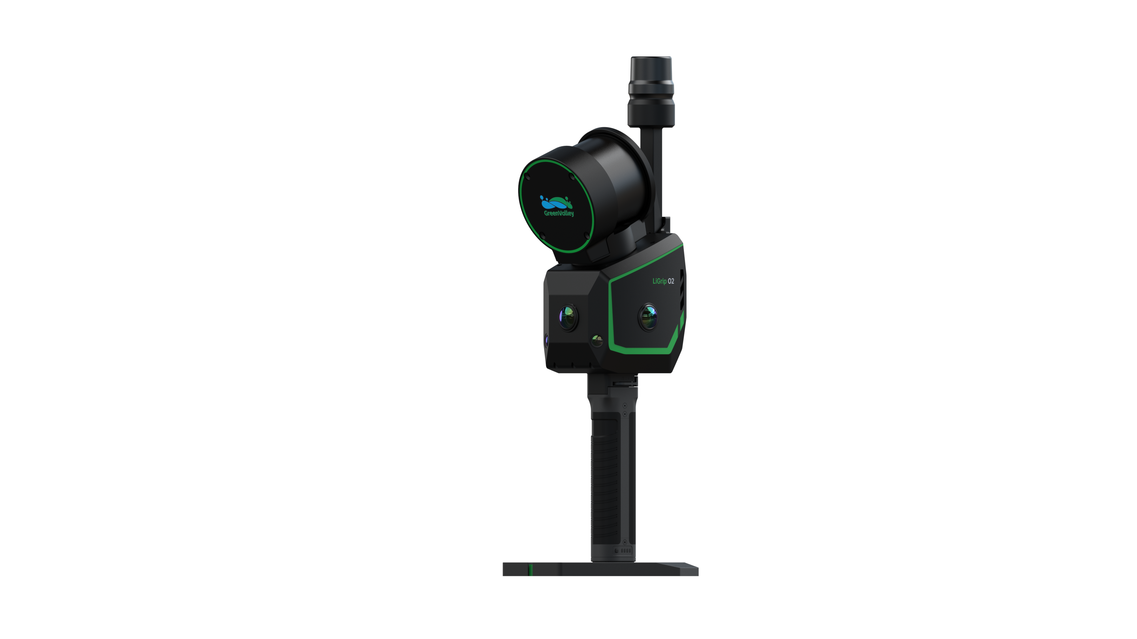
LiGrip O2
LiGrip O2
GreenValley Internationalが開発する次世代ハイエンドハンディ型SLAM LiDARスキャナー「LiGrip O2」は、レーザースキャナー・3台パノラマカメラ・デュアルVSLAMカメラ・GNSSアンテナを一体化したオールインワンデバイスです。環境や時間の制約を受けず、あらゆる方向からの高精度データ取得を実現。RTK/PPK/MLF/標準SLAMなど多様な測位モードを搭載し、電波環境や地形特徴に応じた最適な計測が可能です。
3方向パノラマカメラによる完全3DカバレッジとデュアルVSLAMカメラの連携で、トンネルや地下空間などの低特徴環境でも安定した高精細点群データを取得。独自のマルチセンサーフュージョンSLAM技術により、絶対精度3cm・相対精度1cmの調査級精度を実現し、2mm間隔でのミリ単位点群出力をサポートします。
最大秒間64万点の高速スキャンと300mの検出距離を誇りながら、ベース・バッテリー含む重量はわずか2.2kg。IP64保護等級による防塵防水性能、-20℃〜40℃の広い動作温度範囲、120分の連続駆動、512GB内蔵SSDを備え、Type-Cポートとオフラインアップグレード機能により、過酷な野外環境でも確実に動作する信頼性の高い計測ソリューションです。
The LiGrip O2 is the next generation flagship handheld SLAM LiDAR scanner developed by GreenValley International. This all in one device seamlessly integrates a laser scanner, three panoramic cameras, dual visual SLAM cameras, and a GNSS antenna. This powerful combination enables high precision and all directional data acquisition without being constrained by time or environmental factors.
It supports multiple positioning modes to suit distinctly different working environments. These adaptable modes include RTK SLAM for areas with a strong RTK signal, PPK SLAM for environments without an RTK signal, MLF SLAM specifically designed for low feature environments, and standard SLAM which is best for GNSS denied areas.
Front, left, and right panoramic cameras offer full 3D coverage to greatly simplify data capture. The triple camera coverage significantly enhances point cloud coloring and 3DGS quality. Dual 1.3 megapixel VSLAM cameras successfully cover the full LiDAR range. This VSLAM integration improves mapping stability in low feature areas like tunnels and underground spaces. Powered by GreenValley International self developed multi sensor fusion SLAM technology, the system ensures reliable and survey grade accuracy. The scanner guarantees under 3 centimeters absolute accuracy and under 1 centimeter relative accuracy. It supports point cloud outputs with 2 millimeters spacing for millimeter level and high fidelity reality capture.
The system boasts an impressive scan rate of up to 640,000 points per second and a detection range of up to 300 meters. It is highly portable, weighing as light as 2.2 kilograms with the base and battery included. The device offers a single battery life of 120 minutes and features an IP64 protection level for rugged outdoor environments. It includes a 512 gigabyte SSD for internal storage and operates reliably in temperatures ranging from negative 20 to 40 degrees Celsius. It utilizes a modern Type C port, relies on lithium battery power, and supports offline firmware upgrades.
LiAir X4
LiAir X4
GreenValley Internationalが開発した次世代自律飛行LiDARシステム「LiAirX4」は、軽量32チャンネルLiDAR、高精度GNSS/IMU、高解像度カメラ及びエッジコンピューティング機能を統合した革新的なソリューションです。独自の回転式レーザースキャナーとAirPilot自律飛行アルゴリズムにより、電線追従や地形追従を含む360度完全自律飛行を実現。人為介入を大幅に削減しながら、電力・測量分野における作業効率と安全性の新基準を確立します。
最大の特徴はAI搭載エッジコンピュータによる高速処理能力にあります。40 TOPSの処理性能により、最大10m/sの自律飛行速度と30km/日の効率的な巡視を実現。電線追従飛行では、電柱自動識別・樹木障害検出・導体RGB撮影までを完全自動化。さらに短距離LiDARによる地形追従機能で、高低差の激しい環境でも安定した高精度データ取得が可能となり、従来比で飛躍的な作業効率向上をもたらします。
操作性の革新にも注力し、DJI M300/M350RTKへの簡易設置とGNSSアンテナ不要設計を実現。直感的なUIと26MPカメラによるリアルタイム映像伝送(最大30720FPS相当)により、現場での点群品質評価と即時判断を支援。ハンドヘルドモードとの統合運用で多様な計測ニーズに対応し、スマートインフラ点検の未来を切り拓く次世代ソリューションとして、あらゆるフィールドワークの効率化に貢献します。
The LiAir X4 Plus is a highly intelligent autonomous airborne LiDAR data acquisition system developed by Green Valley International. Serving as a comprehensive upgrade to the predecessor LiAirX4, this new system retains autonomous flight capabilities while successfully integrating a panoramic camera module internally. This structural change results in a much more compact design and allows for noticeably faster switching between airborne and handheld modes. The system smartly combines a lightweight 32 line LiDAR, a high precision INS, a 26 megapixel mapping camera, triple 12 megapixel panoramic cameras, and a high performance edge computing platform.
The LiAir X4 Plus is built for organizations demanding flexible aerial and terrestrial mapping workflows. It features multi mode operation, dynamically supporting handheld, backpack, and airborne modes with modular kits for rapid switching. The system excels in automated inspection flights with advanced functions like Above Powerline Following Flight and Side Powerline Following Flight. Furthermore, it supports Real time Terrain Following Flight by actively constructing a real time DSM.
In handheld mode, a powerful built in SLAM algorithm captures high precision 3D point clouds. The system achieves a centimeter level integration of airborne and handheld mapping data. Equipped with a high precision integrated motor, it performs 360 by 270 degree omnidirectional scanning to detect obstacles in real time. The unit intelligently chooses climbing or bypass strategies based on the environment to ensure safety with minimal manual intervention. By fusing airborne and handheld point clouds with high resolution panoramic images, it enables seamless multi platform data integration. When mounted on aircraft, it actively supports a GNSS antenna free solution.
The LiDAR sensor offers a robust detection range of up to 300 meters. The vertical system accuracy is rated at less than 5 centimeters at a 100 meter distance.