基本情報
出展製品・サービス
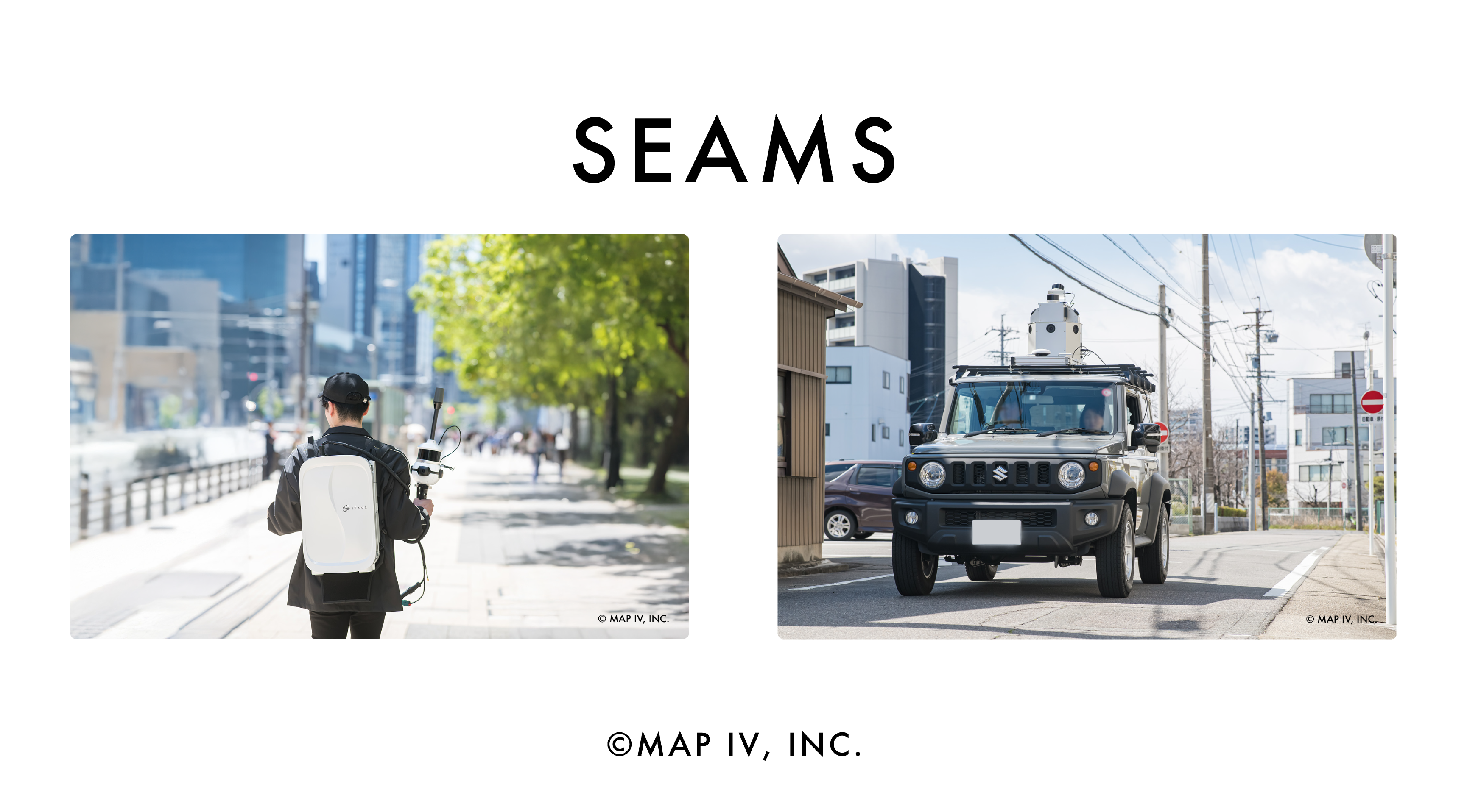
3次元データ計測システム「SEAMS」ウェアラブルモデル/車載モデル
SEAMS - 3D Data Measurement System Wearable Model / Vehicle-Mounted Model
3D-LiDARによるSLAM技術を使用した3次元データ計測システム。
ウェアラブルモデル ME、車載モデル LXの2つのモデルがあります。
会期中、新モデルを展示する予定です。
---Key Features---
• 3D-LiDAR、GNSS、IMU、RGBカメラを搭載
• 取得データをMAP IV Engineで処理することで高精度3次元点群を作成可能
• 地図情報レベル250(水平位置標準偏差0.12m以内)の精度に準拠
• 標定点補正により絶対精度±5cm以内まで精度調整可
• 軽量・コンパクトで高可搬性
• スマートフォン・タブレット端末からデータ計測開始・終了操作が可能
Equipped with multiple sensors such as LiDAR, camera, and IMU. SEAMS helps to collect synchronized data to generate accurate real-world 3D Data point clouds.
Available in two models depending on the area: Wearable and Vehicle-mounted Model.
---Key Features---
- SEAMS data is fully compatible with our proprietary 3D mapping software, MAP IV Engine
- Compliant with the Map Information Level 250 standards
- Accuracy can be adjusted to within +/-5cm using custom control points
- Lightweight, compact, and highly portable
- Operable via smartphone or tablet device

高精度3次元点群地図作成ソフトウェア「MAP IV Engine」
MAP IV Engine - High-Precision 3D Point Cloud Mapping Software
マップフォー独自のSLAMアルゴリズムを使用した3次元点群地図作成ソフトウェアです。
3D LiDARを搭載した車載型 / 歩行型モバイルマッピングシステムや、ドローンなどで取得した3次元データを解析して、3次元点群地図としてデータ化します。
RTK-GNSSやIMUを複合することにより、公共測量にも活用できます。
---Key Features---
・技術的な知識がなくても、簡単な操作で誰でも3次元地図の作成が可能
・特徴量に乏しい場所や、トンネル・階段などの連続的な地形を含む場所でも、センサーデータを正確にマッチング
・計測時間と同等程度の所要時間で3次元地図を高速に作成
Employs our proprietary SLAM algorithm and can create highly accurate and realistic real-world representations in the form of 3D point clouds using data collected from 3D LiDAR sensors.
With the integration of RTK-GNSS and IMU technologies, the data generated by MAP IV Engine can also be utilized for public surveying.
---Key Features---
- Easy 3D map generation without specialized expertise
- Works in open areas or repetitive environments like tunnels and staircases
- Rapid point cloud processing with multi-threading and GPU acceleration, generating 3D maps in the same time as the measurement process

リアルタイム環境モニタリングソフトウェア
Atomic Engine - Real-Time Perception Software
LiDAR、カメラ、Radarなどのセンサデータから対象物を検出・識別する独自開発の物体検出ソフトウェア。検出された物体の速度を追 跡・推定することも可能です。
---Key Features---
• 3次元地図との統合でオブジェクトのトラッキング性能が向上
• 新たなセンサ追加や認識クラス作成などカスタマイズ可能
• ROS1/ROS2のAutowareと互換性があり、用途別にオンライン/オフラインのモード選択が可能
• オンラインモード:リアルタイムに動作し、自動運転システムやスマートポールシステムへの組み込み、各種機能モジュール(自己位置推定機能など)と連携可能
• オフラインモード:後処理解析により高精度化。機械学習用データセットとして利用可能
Detects and identifies objects from sensor data such as LiDAR, cameras, and radar.
Capable of tracking and estimating the velocity of detected objects.
---Key Features---
- Monitor fixed locations, such as smart poles, and for environmental detection on moving platforms, such as vehicles or advanced robots
- Integration with 3D maps improves object tracking performance
- Customization options include adding new sensors and creating recognition classes
- Support for a Wide Range of Sensor Models
