基本情報
出展製品・サービス
三次元点群測量総合プランニング
Comprehensive Planning of 3D PointCloud Surveys
豊富な機材と専門知識を活かし、三次元点群測量総合プランニングを幅広く提供します。
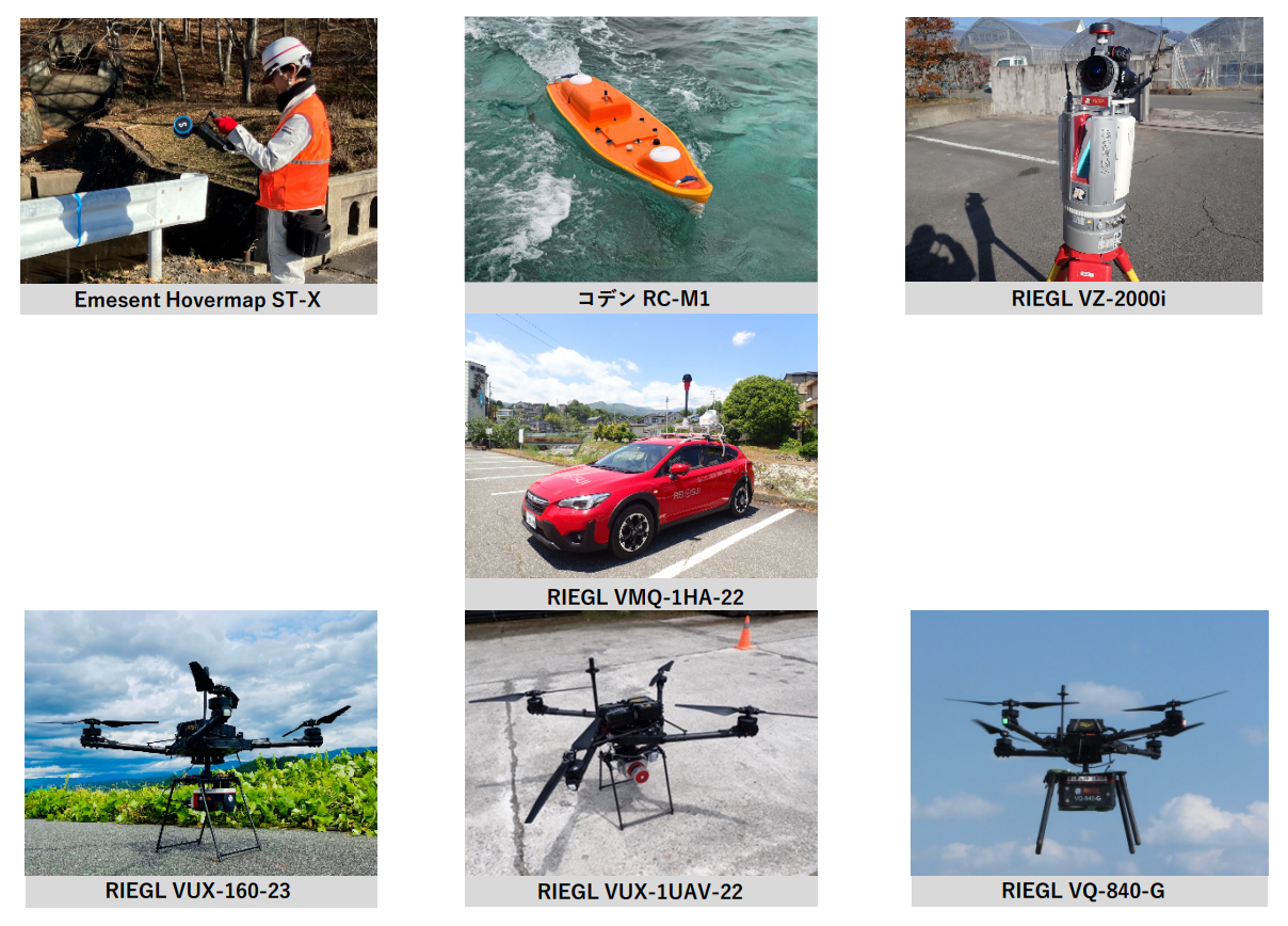
■三次元計測機器
・地上型レーザスキャナ「RIEGL VZ-2000i」:
長距離かつ高精度な測定が可能で、災害や工事現場など広域地形の計測に最適です。
・車載型レーザスキャナ「RIEGL VMQ-1HA-22」:
交通規制不要で自動運転計測。レーザ測距と写真撮影を同時に行い、色付き点群を作成します。
・SLAMレーザスキャナ「EMESENT Hovermap ST-X」:
測量基準を満たす唯一のLiDAR SLAMで、RIEGL(VUX)に匹敵する実精度を誇ります。
・マルチビーム音響測深機「コデン RC-M1」:
ダム湖、河川、港湾をラジコン操作で測深。測深範囲0.5m~80mで浅部深部幅広く対応可能です。
当社独自のシステム構成により、ネットワーク不通区域でも確実に測量を遂行します。
・UAVレーザ「VQ-840-G(グリーン)」:
測量基準準拠のドローン測深機で、2セッキ(透明度の2倍)まで計測可能、ボートが入れない水深が浅い部分でも計測できます。流れの速い河川・ダム湖・港湾・沿岸などの困難箇所で幅広く活躍します。
・UAVレーザ「VUX-1UAV-22」:
測量基準で作られたレーザスキャナ。公共事業での高評価を続々獲得しています。
・UAVレーザ「VUX-160-23」:
UAV次世代型レーザシステムの最上位機種。高精度を確保しつつ、広範囲のデータ取得が可能です。
これらの高性能な機材を用いて、三次元点群測量のプロフェッショナルが多様な現場ニーズにお応えします。
Leveraging our extensive instruments and specialized expertise, we provide comprehensive planning for 3D point cloud surveying across a wide range of applications.
■3D Measuring Instruments
・Terrestrial Laser Scanner “RIEGL VZ-2000i”:
Capable of long-range, high-precision measurements, making it ideal for surveying large-scale terrains such as disaster areas and construction sites.
・Mobile Mapping System “RIEGL VMQ-1HA-22”:
Enables automated data acquisition without traffic restrictions. It simultaneously performs laser scanning and photography to generate colorized point clouds.
・SLAM Laser Scanner “EMESENT Hovermap ST-X”:
A LiDAR SLAM system that meets surveying standards, offering accuracy comparable to RIEGL (VUX) systems.
・Mobile Mapping System “CODEN RC-M1”:
Conducts depth measurements in dam lakes, rivers, and harbors via remote control. It covers a depth range of 0.5 m to 80 m, enabling surveys in both shallow and deep waters.
Our proprietary system configuration ensures reliable surveying even in areas without network connectivity.
・Survey-grade UAV LiDAR “VQ-840-G”:
A drone-based bathymetric LiDAR compliant with survey standards, capable of measuring up to twice the Secchi depth. It can also survey shallow areas inaccessible by boat and performs effectively in challenging environments such as fast-flowing rivers, dam lakes, harbors, and coastal areas.
・Survey-grade UAV LiDAR “VUX-1UAV-22”:
A laser scanner designed in accordance with surveying standards, receiving high evaluations in public works projects.
・Survey-grade UAV LiDAR “VUX-160-23”:
The flagship next-generation UAV laser system, delivering both high accuracy and wide-area data acquisition.
Using these high-performance instruments, our team of 3D point cloud surveying professionals is equipped to meet a wide variety of on-site requirements.
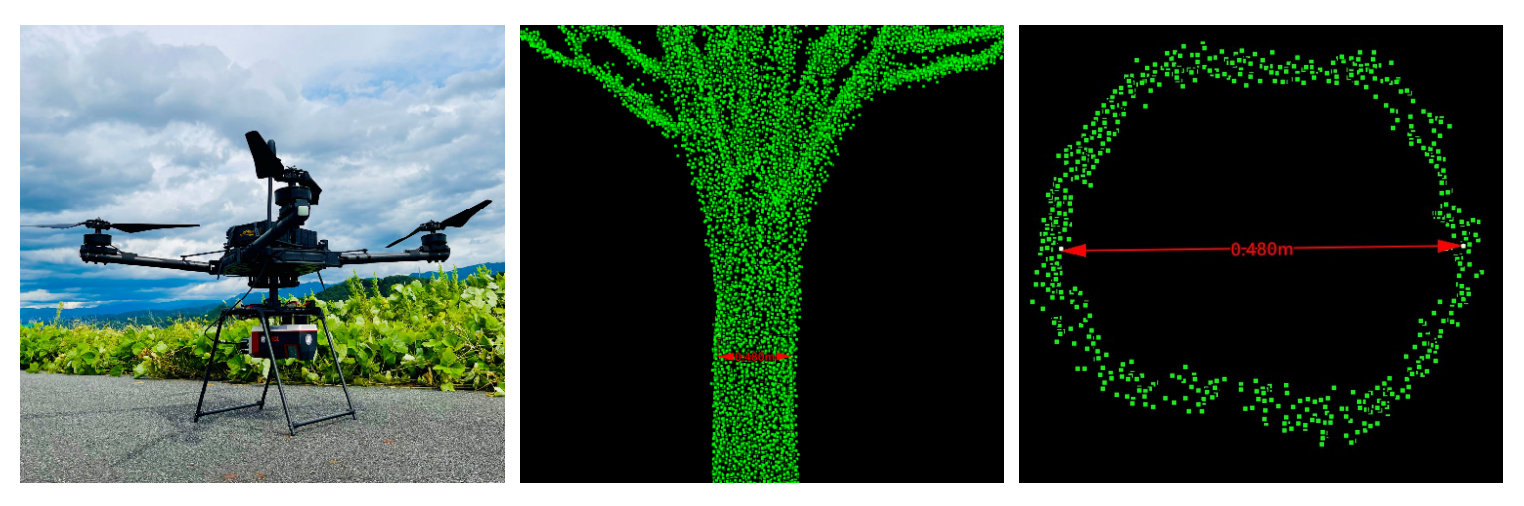
【超絶精度】RIEGL VUX-160-23 with AP+50
Get the ULTIMET HQ PointCloud by RIEGL VUX-160-23 with AP+50
VUX-160-23はUAV次世代型レーザシステムの最上位機種。高精度を確保しつつ、広範囲のデータ取得が可能です。
測定ビームは、直下、前後10度の三方向に照射され、VUX-1と比較して植生貫通力が大きいことが特徴です。また、下位機種(VUX-120)と比較して、最大計測距離が長く、植生下の微弱なレーザ反射でも確実に検出。他機種とは比較にならない高密度な地表面データを取得することができます。
他社のスキャナでは不可能であった樹木の正確な胸高直径の検出も、本機種では可能です。
The VUX-160-23 is the flagship model of a next-generation UAV LiDAR system, capable of acquiring wide-area data while maintaining high accuracy.
Its measurement beams are emitted in three directions—directly downward, and 10 degrees forward and backward—providing superior vegetation penetration compared to the VUX-1. In addition, compared to the lower-end model (VUX-120), it offers a longer maximum measurement range and can reliably detect even weak laser reflections beneath vegetation. This enables the acquisition of exceptionally high-density ground surface data unmatched by other systems.
Furthermore, this model can accurately detect tree diameter at breast height (DBH), a capability that was not achievable with conventional scanners from other manufacturers.
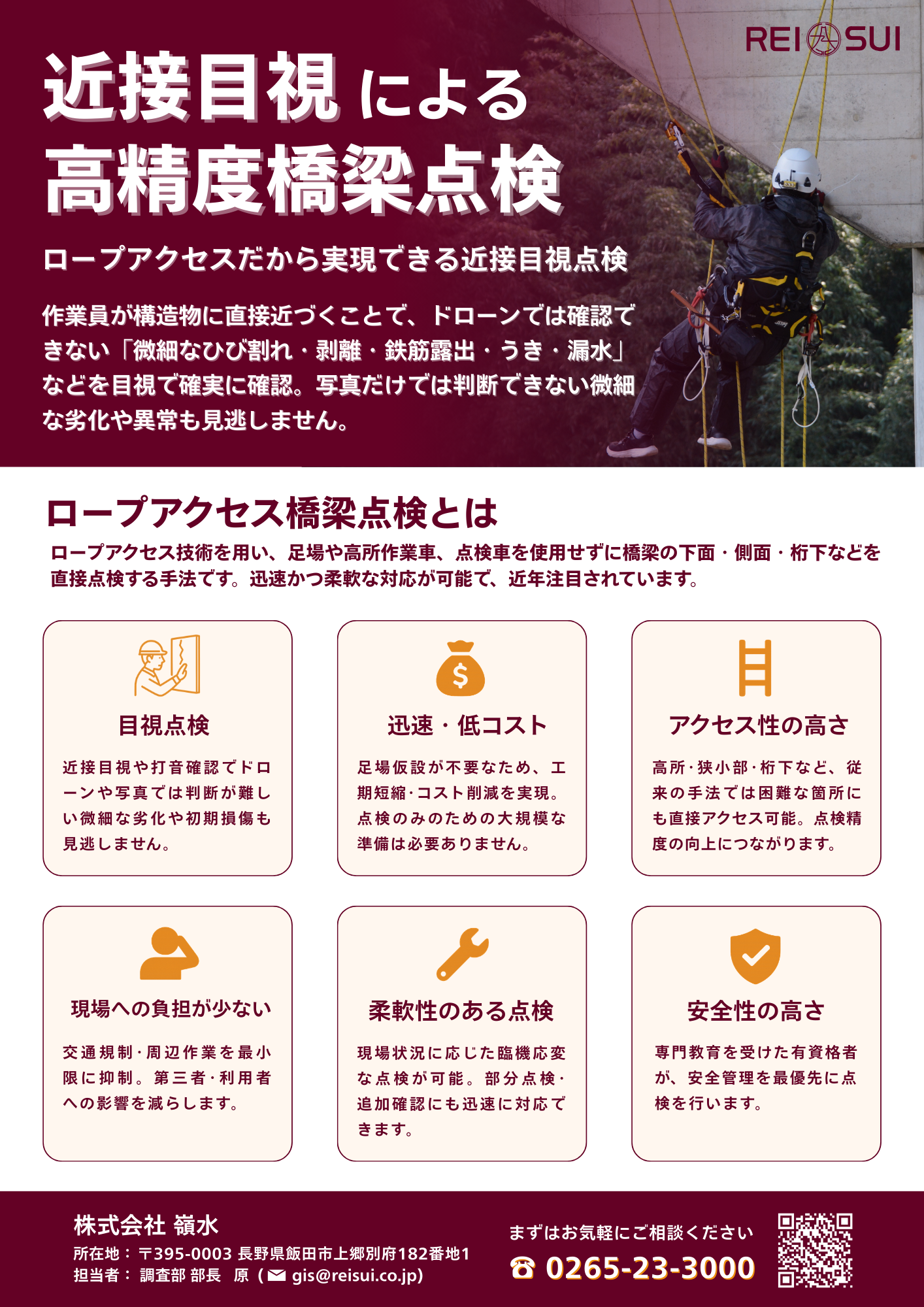
ロープアクセスによる高精度近接目視橋梁点検サービス
When drones and robots reach their limits, rope access delivers.
ドローン技術に精通しているからこそわかる、ロボット等を用いた橋梁点検における課題を、ロープアクセス技術により解決します。
ドローン画像からのひび割れ抽出における誤抽出で苦労していませんか?
0.1mm単位のヒビ判定、剥離・鉄筋露出・漏水・うきの判定、結局は人力に頼っていませんか?
人力でなければ無理なものは無理!足場設置は費用も工期も莫大にかかってもっと無理!
そんな「無理」をロープアクセスが解決します。
Because we know drone technology inside and out, we understand the real challenges of bridge inspection with robots and advanced systems—and we solve them with rope access.
Are false crack detections from drone imagery slowing you down?
When it comes to identifying cracks as fine as 0.1 mm, or assessing delamination, exposed rebar, water leakage, and hollow areas, are you still forced to rely on manual inspection in the end?
Some things simply cannot be done without human hands and eyes.
And scaffolding? Even less practical—too much cost, too much time.
Rope access solves the “impossible.”