基本情報
出展製品・サービス
Jupiter Laser Visual RTK
Jupiter Laser Visual RTK
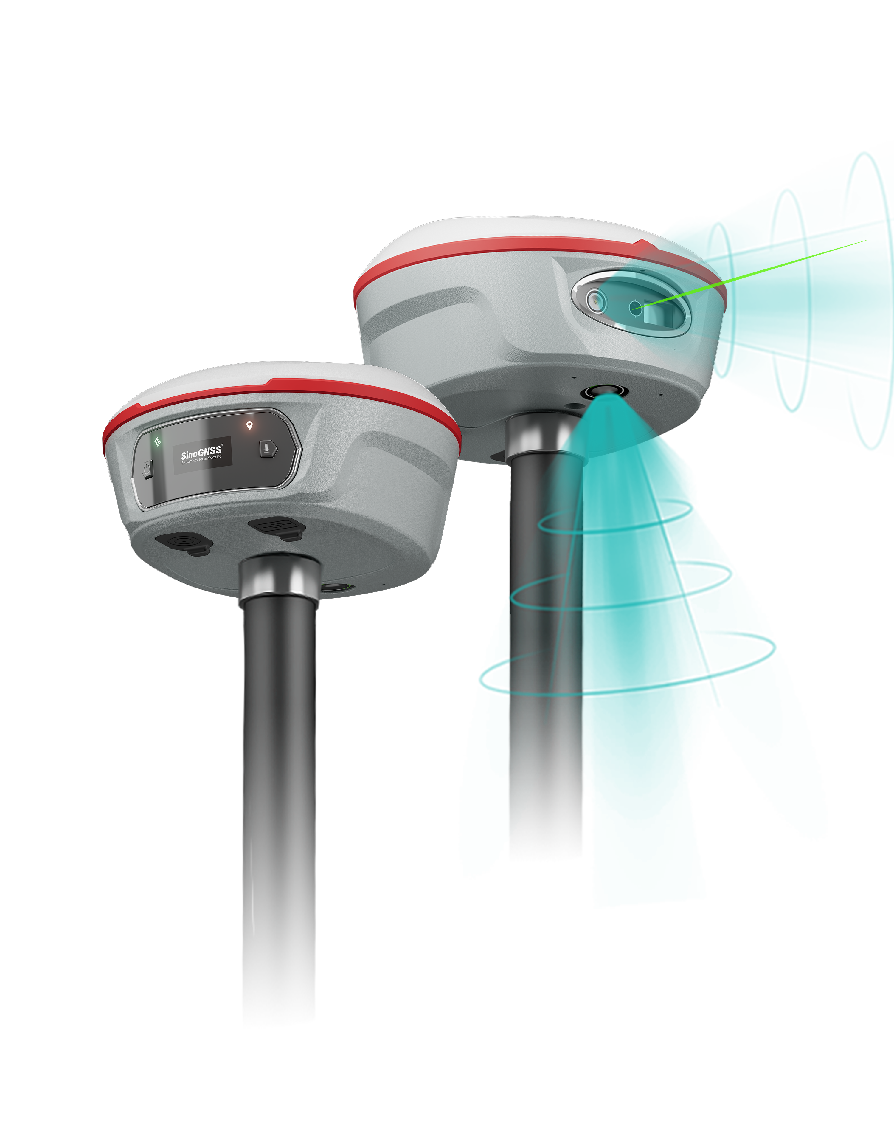
Jupiter Laser Visual RTKは、最先端のGNSS、IMU、レーザー、デュアルカメラ技術を統合したハイエンドGNSS受信機です。この組み合わせにより、これまで到達が困難であった場所や、信号が遮断された場所、危険な場所でも、没入感のある測量や杭打ち作業を体験できます。
Jupiter Laser Visual RTK is a high-end GNSS receiver that integrates cutting-edge GNSS, IMU, Laser and dual-camera technologies. Building on the advanced laser technology of the Universe Series, Jupiter also incorporates SinoGNSS’s latest visual stake-out technology. This combination brings out immersive surveying and stakeout experiences, even in previously hard-to-reach, signal-blocked, or dangerous field.
LS600 レーザースキャニングシステム
LS600 Laser Scanner
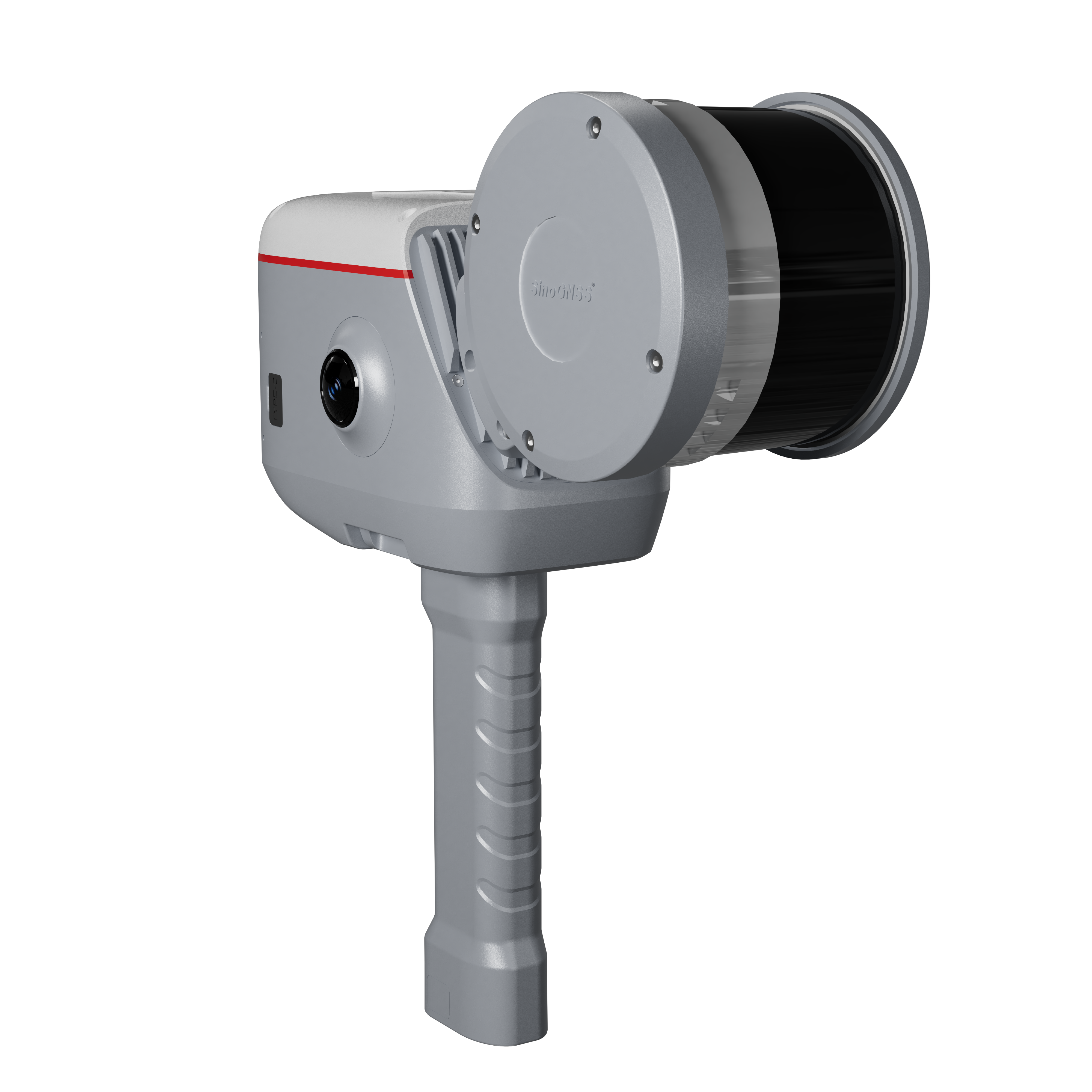
LS600は、高度なSLAM技術、センチメートル単位の精度を実現するRTKモジュール、鮮やかな色彩を捉える2つの広角カメラをシームレスに組み合わせた次世代の携帯型3Dレーザースキャナーです。
The LS600 is a next-generation handheld 3D laser scanner that seamlessly combines advanced SLAM technology, a built-in RTK module for centimeter-level accuracy, and dual wide-angle cameras for vivid color capture.
P6Hハンドヘルド
P6H Handheld
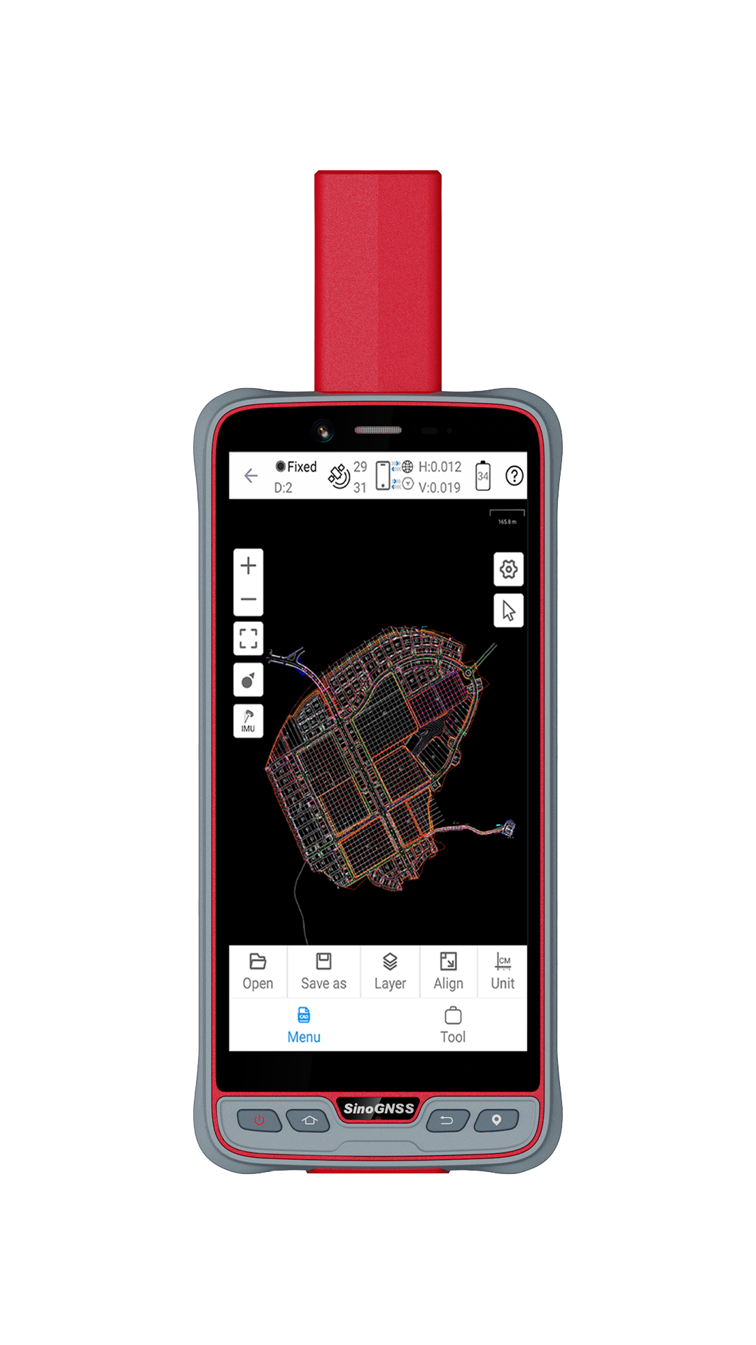
P6Hハンドヘルドは地理情報システム(GIS)用に設計された先進的で頑丈なデバイスです。SinoGNSSが独自に開発した高精度K8ボードとアンテナを搭載し、GPS、BDS、GLONASS、GALILEO、QZSS、IRNSS、SBASなど、稼働中および計画中のすべてのコンステレーションを追跡します。その精度は、センチメートルまたはデシメートルレベルです。その携帯性と耐久性により、過酷な条件下でも信頼できます。
The P6H Handheld is an advanced, rugged device tailored for Geographic Information System (GIS). Equipped with SinoGNSS self-developed high precision K8 board and antenna, it tracks all running and planned constellations, including GPS, BDS, GLONASS, GALILEO, QZSS, IRNSS and SBAS. Its accuracy remains at centimeter or decimeter level. Its portability and durability make it reliable even in harsh conditions.
共同出展社:コムナブ・テクノロジー
共同出展社:ComNav Technology
T100 Pocket
T100 Pocket
T100 Pocket は、最新のGNSS、IMU をコンパクトなポケットサイズに統合し、お求めやすい価格を実現したGNSS スマートアンテナです。低価格ながら、T100 Pocket には最新のK8 プラットフォームが搭載されており、現在稼働中のすべての衛星を1598 チャンネルで追跡します。内蔵のIMU センサーは最大60°の傾き補正に対応し、高精度な測量結果が得られます。
The T100 Pocket is a GNSS smart antenna that integrates the latest GNSS and IMU into a compact, pocket-sized unit at an affordable price. Despite its low price, the T100 Pocket is equipped with the latest K8 platform and tracks all currently active satellites in 1598 channels. The built-in IMU sensor supports tilt compensation of up to 60 degree, enabling highly accurate survey results.

XE100ガイダンスシステム
XE100 Guidance System
XE100ガイダンスシステムは、ComNavテクノロジーが開発・製造した油圧ショベル用のガイダンスシステムです。このシステムは高精度のGNSS測位とヘディングテクノロジー、慣性センサーを採用しています。整地、斜面切断、掘削等の作業でバケットの制御において、オペレータに正確なガイダンスを提供します。手作業による杭打ちが不要になるため、効率と生産性が向上します。従来の作業と比べ、より短時間でセンチメートルレベルの精度を達成し、手戻りを減らし、効率を大幅に向上させ、より高い品質を確保することができます。
The XE100 Guidance System is developed and manufactured by ComNav Technology Ltd. for excavators. The system employs high-precision GNSS positioning and heading technology, and inertial sensors as well. It can provide precise guidance to drivers to control the bucket for tasks, such as levelling, slope cutting, digging, etc. Efficiency and productivity can be improved by eliminating the need for manual staking. Compared with traditional operation, it can achieve centimeter-level accuracy in less time, decrease rework, significantly increasing efficiency and ensuring higher quality.

CORSソリューション
CORS solution
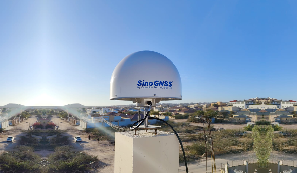
ComNavのCORSソリューションは、GNSS受信機とソフトウェアを搭載した先進的な統合システムであり、堅牢で将来性のある測位機能を提供するように設計されています。その中核となるのは、SinoGNSS QUANTUMテクノロジーとフルコンステレーション・トラッキングを搭載したM300 Pro GNSSリファレンスステーションであり、高い信頼性と精度を保証します。このソリューションは、連続的なネットワーク処理にCDC.NETを活用し、最小限の基準局で広範囲にわたる高精度RTKサービスを可能にします。この多用途ソリューションは、地域および国家測位インフラ、モニタリング、測量、GIS、精密農業、機械誘導、無人車両、森林管理、UAVナビゲーション、測地調査など、幅広い用途に対応しています。
ComNav’s CORS solution is an advanced, integrated system featuring GNSS receivers and software, designed to deliver robust and future-proof positioning capabilities. At its core is the M300 Pro GNSS reference station, equipped with SinoGNSS QUANTUM Technology and full-constellation tracking, ensuring high reliability and precision. The solution leverages CDC.NET for continuous network processing, enabling high-accuracy RTK services across extensive regions with minimal reference stations. This versatile solution supports a wide range of applications, including regional and national positioning infrastructures, monitoring, surveying, GIS, precision agriculture, machine guidance, driverless vehicles, forestry management, UAV navigation, and geodetic surveys.