基本情報
出展製品・サービス
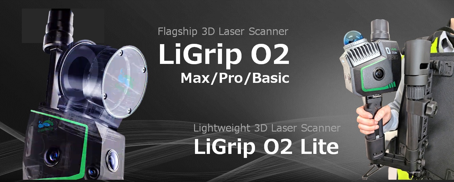
V-SLAM搭載の高性能3Dハンディスキャナ
High-performance 3D handheld scanner with V-SLAM technology
GreenValley LiGrip O2 / LiGrip O2 Lite は、歩きながらスキャンするだけで現場をそのまま3Dデータ化できる、V-SLAM搭載のハンディスキャナです。
機器を手に持ち、対象エリアを歩いて移動するだけで、周囲の形状と特徴点をリアルタイムに認識し、自身の位置を高精度に推定しながら点群データを取得します。従来のように測点を一つひとつ設置する必要はなく、広範囲でも短時間で計測が完了します。
V-SLAM技術により、GNSSが届かない屋内やトンネル、プラント設備内といった環境でも安定した測位を維持。環境条件に左右されにくく、誰が操作しても均一で再現性の高い成果を得ることが可能です。
取得したデータは専用ソフトと連携し、解析・モデリングまでスムーズに展開。現場作業の省力化とデータ活用の高度化を同時に実現し、測量業務の効率と価値を大きく向上させます。
The GreenValley LiGrip O2 / LiGrip O2 Lite is a V-SLAM-equipped handheld scanner that can create 3D data of a site simply by scanning while walking.
By holding the device and walking around the target area, it recognizes the surrounding shape and feature points in real time, accurately estimates its own position, and acquires point cloud data. Unlike conventional methods that require setting up individual measurement points, it allows for quick measurement of large areas.
V-SLAM technology maintains stable positioning even in environments where GNSS signals are unavailable, such as indoors, tunnels, and plant facilities. It is less affected by environmental conditions, ensuring consistent and highly reproducible results regardless of who is operating it.
The acquired data can be seamlessly integrated with dedicated software for analysis and modeling. This simultaneously reduces labor in field work and enhances data utilization, significantly improving the efficiency and value of surveying operations.
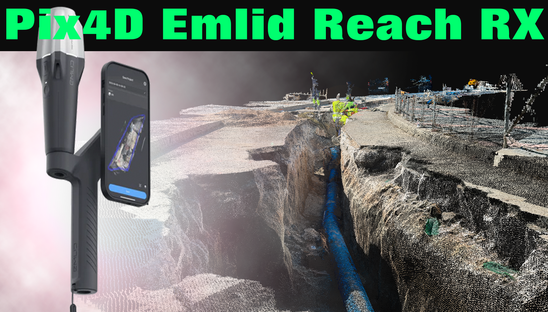
その場で、誰でもすぐに、“cm精度”を手に。 - Pix4D Emlid Reach RX
Anyone can instantly achieve "cm-level accuracy" on the spot. – Pix4D Emlid Reach RX
Emlid Reach RX は、スマートフォンと連携するだけで、誰でも簡単にセンチメートル級の高精度測位を実現できるGNSSレシーバーです。専用アプリと組み合わせることで複雑な設定を必要とせず、現場ですぐに利用開始できる手軽さが大きな特長です。
軽量・コンパクトな設計により持ち運びや設置もスムーズで、ドローン測量におけるGCP取得や位置出し、簡易測量など、日常業務の中で“すぐに使える高精度”を提供します。
「高精度機器は高価で扱いが難しい」「もっと手軽に測位したい」――そんな現場の声に応える現実的な選択肢です。スマホとつなぐだけでcm級測位を実現し、専門知識がなくても安定した成果を得られるため、初めての高精度GNSS導入にも最適です。
さらに、本格的な3D計測や高度解析へのステップとしても活躍。まずは手軽に高精度を体感したい方、既存業務の効率をすぐに改善したい方にとって、“その場で、すぐに、高精度”を実現する一台です。
The Emlid Reach RX is a GNSS receiver that enables anyone to easily achieve centimeter-level high-precision positioning simply by connecting it to a smartphone. Its ease of use is a major feature, as it requires no complex setup when combined with a dedicated app, allowing for immediate use in the field.
Its lightweight and compact design makes it easy to carry and set up, providing "immediately usable high precision" for everyday tasks such as GCP acquisition and positioning in drone surveying, and simple surveying.
It’s a practical option that addresses the needs of those in the field who say, "High-precision equipment is expensive and difficult to handle," and "We want positioning that’s easier to do." It achieves centimeter-level positioning simply by connecting to a smartphone, and provides stable results even without specialized knowledge, making it ideal for first-time high-precision GNSS implementations.
Furthermore, it also serves as a stepping stone to full-fledged 3D measurement and advanced analysis. For those who want to easily experience high precision, or those who want to immediately improve the efficiency of existing operations, this is a device that delivers "high precision, on the spot, immediately."
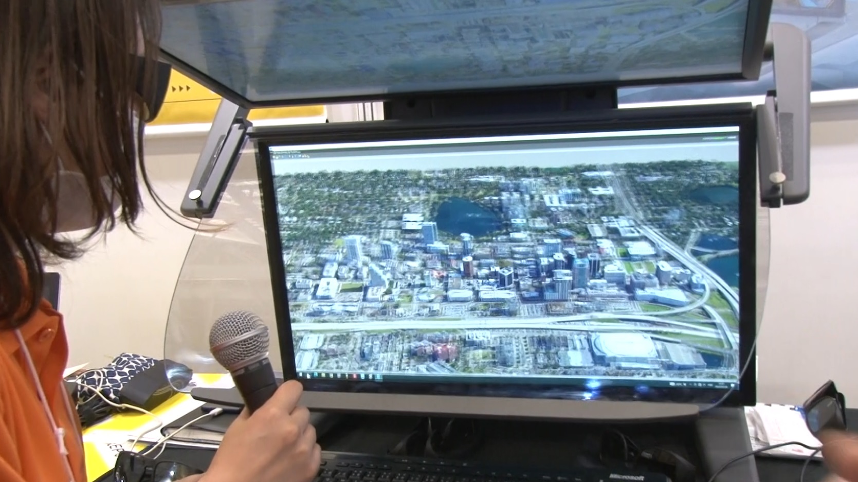
次元を“体感”せよ。3Dデータは、もう平面ではない。 - 3D PluraView
Experience dimensions. 3D data is no longer two-dimensional. – 3D PluraView
3D-PluraViewは、ステレオ立体視に特化した高精細ディスプレイシステムで、これまでの2Dモニタでは得られなかった“奥行き”と“距離感”を、直感的かつ正確に把握できます。点群データや3Dモデルの確認・編集において、対象物の位置関係や高さの違いを一目で理解できるため、作業効率と精度を大幅に向上させます。
特に、測量・土木・建設・インフラ点検などの分野では、微妙な形状差や干渉確認が重要ですが、3D-PluraViewなら視覚的な誤認を減らし、判断のスピードと信頼性を高めます。また、長時間の作業でも疲れにくい設計により、現場データの解析業務を快適にサポート。専用のステレオ表示技術により、クロストークの少ないクリアな立体視を実現しています。
「見る」から「感じる」へ――3D-PluraViewは、3Dデータ活用の新たなスタンダードを提案します。
ぜひ、その圧倒的な没入感と作業性の違いをご体感ください。
3D-PluraView is a high-definition display system specializing in stereoscopic viewing, allowing users to intuitively and accurately grasp "depth" and "distance" in a way that was previously impossible with 2D monitors. When reviewing and editing point cloud data and 3D models, the positional relationships and height differences of objects can be understood at a glance, significantly improving work efficiency and accuracy.
Particularly in fields such as surveying, civil engineering, construction, and infrastructure inspection, where subtle shape differences and interference checks are crucial, 3D-PluraView reduces visual misinterpretations, increasing the speed and reliability of decision-making. Furthermore, its design minimizes fatigue even during long work sessions, comfortably supporting on-site data analysis. Dedicated stereo display technology achieves clear stereoscopic viewing with minimal crosstalk.
From "seeing" to "feeling"—3D-PluraView proposes a new standard for 3D data utilization. Please experience its overwhelming immersion and the difference in workability at the exhibition.