基本情報
Backed by an elite team of engineers and a fully integrated, state-of-the-art R&D-to-production pipeline,we deliver survey-grade hardware engineered for exceptional stability and professional-tier accuracy.
Backed by an elite team of engineers and a fully integrated, state-of-the-art R&D-to-production pipeline,we deliver survey-grade hardware engineered for exceptional stability and professional-tier accuracy.
出展製品・サービス
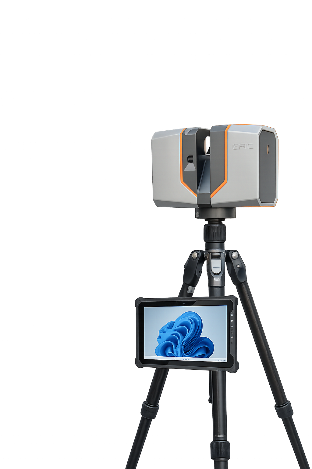
High-precision Terrestrial Laser Scanner T150
High-precision Terrestrial Laser Scanner T150
The T150 features a lightweight design with a high-precision ranging system and an integrated HDR panoramic imaging system, enabling rapid acquisition of dense 3D point clouds with high-resolution color texture.Equipped with an integrated field processing software, the system supports scanning control, real-time point cloud registration, automatic multi-station adjustment, visual measurement, and point cloud colorization, providing a seamless end-to-end workflow from data capture to deliverable output.
By transferring key office processing tasks directly to the field, T150 delivers an accurate and efficient 3D scanning solution for demanding project.
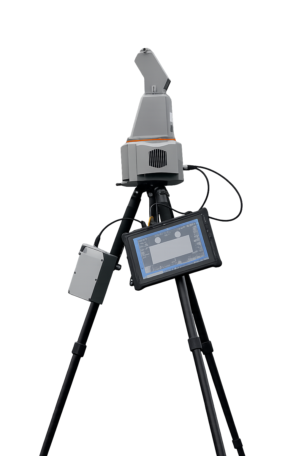
Long-range Terrestrial Laser Scanner
Long-range Terrestrial Laser Scanner
T1000 is a fully self-developed high-precision and long range of terrestrial laser scanner. The system is designed to be most compact and portable. It can capture 3D topographic data in a wider landscape quickly, enabling to acquire true color of 3D point cloud in most demanding scenarios.
T1000 is a fully self-developed high-precision and long range of terrestrial laser scanner. The system is designed to be most compact and portable. It can capture 3D topographic data in a wider landscape quickly, enabling to acquire true color of 3D point cloud in most demanding scenarios.
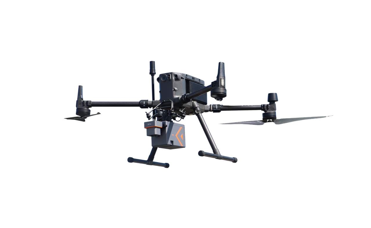
UAV LiDAR system W50
UAV LiDAR system W50
W50 is designed as a highly integrated airborne LiDAR system and its core parts are fully developed by EPiC LiDAR, including high-performance LiDAR, IMU and aerial camera.It features long scanning range,lightweight, strong penetration and higher working efficiency than ever, which can deal with the most challenging and complex scenarios.
W50 is designed as a highly integrated airborne LiDAR system and its core parts are fully developed by EPiC LiDAR, including high-performance LiDAR, IMU and aerial camera.It features long scanning range,lightweight, strong penetration and higher working efficiency than ever, which can deal with the most challenging and complex scenarios.