基本情報
水際・植生下まで捉えるTDOT GREENシリーズと、現場運用に応える国産産業用ドローンGLOW Rev2.0。
測量の精度と効率を、次のステージへ。CSPI-EXPOで体感。
TDOT GREEN captures shorelines and terrain beneath vegetation, together with the Japan-made industrial drone GLOW Rev.2.0 built for on-site operations.
Elevating surveying accuracy and efficiency to the next stage. See it at CSPI‑EXPO.
出展製品・サービス
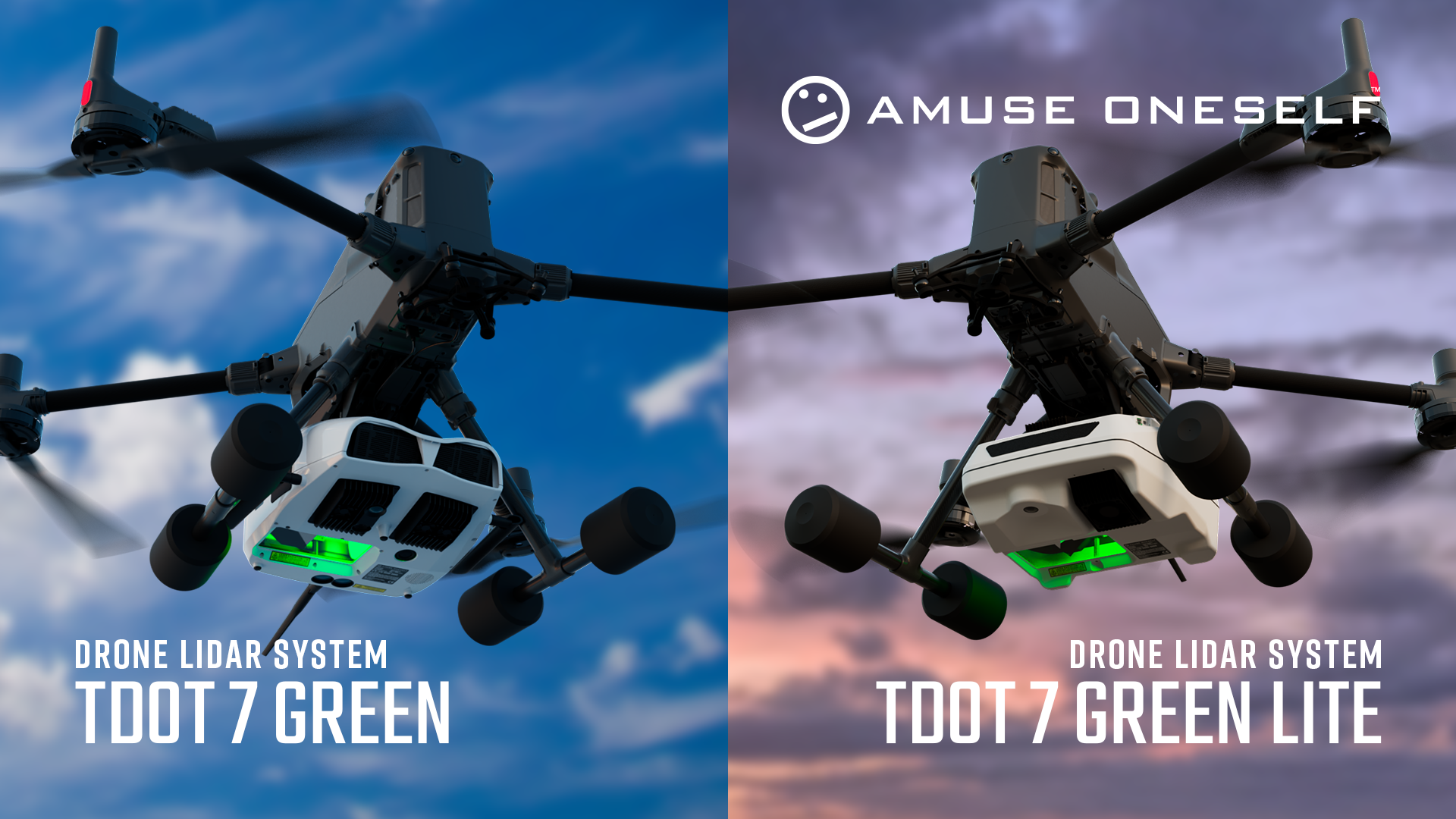
死角を抑え測量範囲を広げるドローン用グリーンレーザー「TDOT 7 GREEN」
Reducing blind spots and expanding survey coverage - Drone-mounted green laser system “TDOT 7 GREEN.”
TDOT 7 GREENシリーズは、水や濡れた地面に光が吸収されにくいグリーンレーザーを搭載したドローン用レーザー測量システムです。雨上がりの現場や水たまり、水際・浅水域、植生下など、従来はデータ欠損が発生しやすかった環境でも安定した点群取得を可能にします。
広視野角120°の設計により、一度のフライトで広範囲を計測でき、再測や作業回数を削減。急斜面や構造物周辺でも、安全な距離を保ったまま測量が行えます。可視光カメラの標準搭載によりカラー点群やオルソ画像の作成にも対応し、成果を直感的に伝える実用性の高い一台です。
TDOT 7 GREEN LITE is a drone laser surveying system equipped with a green laser that is less likely to have its light absorbed by water or wet ground.
It enables stable point cloud acquisition even in environments that previously tended to cause data loss, such as post-rain sites, puddles, shorelines and shallow water areas, and under vegetation.
Its wide 120° field-of-view design allows measurement of large areas in a single flight, reducing re-surveys and the number of operations.
Surveys can be conducted while maintaining a safe distance even on steep slopes and around structures.
With the standard inclusion of a visible-light camera, it also supports creating color point clouds and orthoimages, making it a highly practical unit for intuitively communicating results.
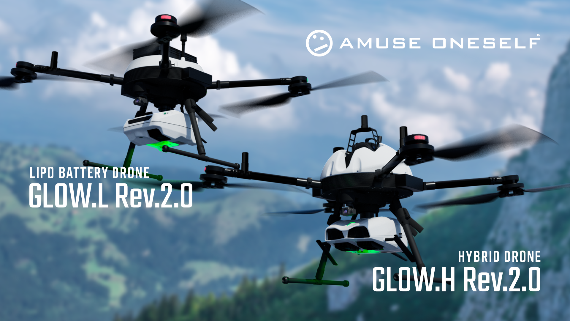
現場が求める飛び続ける力を形にした産業用国産ドローン「GLOW Rev.2.0」
GLOW Rev.2.0 - Japan-made industrial drone shaped around the "ability to keep flying" demanded by the field
GLOW Rev.2.0シリーズは、測量・点検・防災といった実務の現場で求められる信頼性と運用性を追求し、日本国内で開発・製造された産業用国産ドローンです。日本の法規制や現場特有の運用条件を前提に設計されており、導入から運用、保守までを一貫して支える国産機ならではの安心感を備えています。
最大の特長は、計測機材を安定して運用できる高い可搬性能です。
GLOW L Rev.2.0は約5kgのペイロードと60分の飛行性能(無積載時)、GLOW H Rev.2.0は約2.5kgのペイロードと約3時間の長時間飛行(無積載時)に対応し、レーザースキャナやオブリークカメラ、一眼レフカメラ、サーマルカメラなど、多様な機材搭載を想定しています。
重量物を搭載しても安定した飛行性能を維持でき、ミッションの幅を大きく広げます。
The GLOW Rev.2.0 series is a domestically developed and manufactured Japan-made industrial drone that pursues the reliability and operability required in practical fields such as surveying, inspection, and disaster prevention.
It is designed based on Japanese regulations and site-specific operational conditions, and offers the peace of mind unique to domestically made aircraft that consistently support everything from installation to operation and maintenance.
Its greatest feature is high payload capacity that can stably carry measurement equipment.
GLOW.L Rev.2.0 supports a payload of approximately 5 kg, and GLOW.H Rev.2.0 supports approximately 2.5 kg, accommodating a variety of equipment such as laser scanners, oblique cameras, DSLR cameras, and thermal cameras.
It maintains stable flight performance even when carrying heavy loads, greatly expanding the range of missions.
機材・運用・成果までを一体で支える「アミューズワンセルフのドローン測量サービス」
A one-stop drone surveying service by amuse oneself, integrating hardware, flight operations, and final deliverables
アミューズワンセルフのドローン測量サービスは、ドローンやレーザースキャナといった機材の提供にとどまらず、現場で“本当に使える測量”を実現するための総合的なソリューションです。自社開発のグリーンレーザー測量システム「TDOT GREENシリーズ」と、産業用国産ドローン「GLOW Rev.2.0」を組み合わせることで、陸上・濡れた地面・植生下・水際や浅水域まで、従来は取得が難しかった領域の正確なデータ取得を可能にします。
計測精度だけでなく、現場での安全性と作業効率も重視した運用設計が特長です。可搬性に優れた機体構成により、限られた時間や人員でもスムーズな現場対応を実現。危険箇所への立ち入りを最小限に抑え、広範囲を一度に測量することで、再測や手戻りのリスクを低減します。
さらに、アミューズワンセルフは、測量フライトだけでなく、データ処理や成果物作成までを見据えたサポートを提供。取得した点群データや画像データを、業務にそのまま活用できる形に整理し、報告・設計・検討業務までスムーズにつなげます。
現場を知り、機材を知り、測量実務を理解しているからこそ提供できる、安心と実用性を兼ね備えたドローン測量サービスです。
The drone surveying service by amuse oneself goes beyond simply providing equipment such as drones and laser scanners. It is a comprehensive solution designed to deliver surveying results that are truly practical and usable in real-world field operations. By combining our in-house developed green laser surveying system “TDOT” with the industrial, Japan-made industrial drone “GLOW Rev.2.0,” we enable accurate data acquisition across areas that were previously difficult to survey, including dry land, wet and rain-soaked surfaces, areas beneath vegetation, shorelines, and shallow water zones.
In addition to high measurement accuracy, the service is characterized by an operational design that prioritizes on-site safety and work efficiency. Thanks to highly portable aircraft configurations, smooth field operations can be carried out even with limited time and personnel. By minimizing the need to enter hazardous areas and surveying wide areas in a single flight, the risk of re-surveying and operational rework is significantly reduced.
Furthermore, amuse oneself provides support that extends beyond flight operations to include data processing and the preparation of final deliverables. Acquired point cloud and image data are organized into formats that can be directly utilized in professional workflows, seamlessly connecting surveying results to reporting, design, and planning tasks.
This drone surveying service combines reliability and practicality—made possible because we understand the realities of the field, the capabilities of the equipment, and the requirements of surveying operations.