基本情報
出展製品・サービス
Mars Pro Laser RTK
Mars Pro Laser RTK
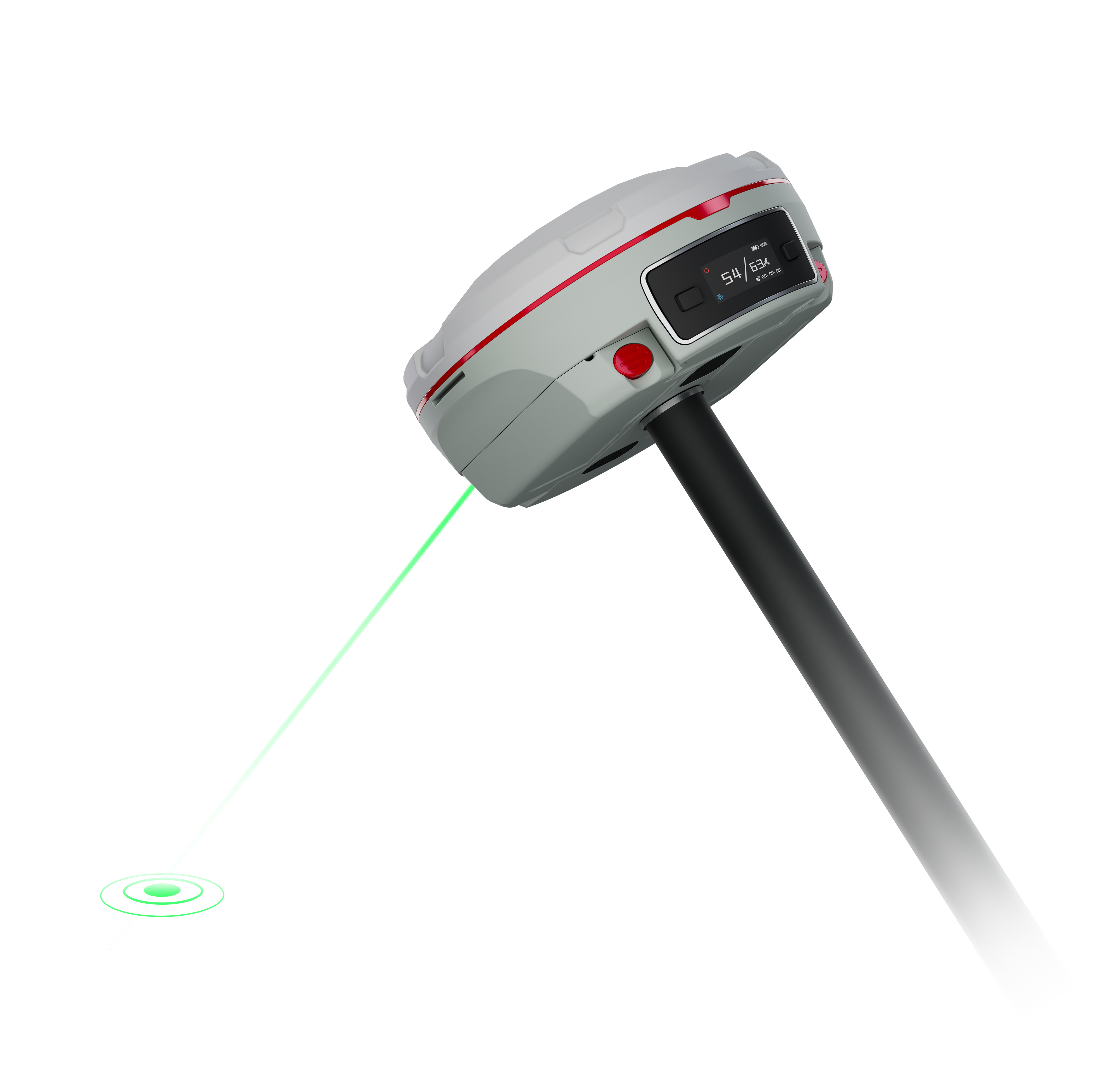
The Mars Pro is an ultra-reliable GNSS receiver with a millimeter-level laser, enabling it to handle complex surveying tasks with unmatched precision, for example, in hard-to-reach, signal-obstructed, and dangerous fields. Mars Pro also features a sunlight-readable OLED color display for user-friendly, high-end operations. With 1668 channels tracking all running and planned constellations, including GPS, BDS-2, BDS-3, GLONASS, Galileo, QZSS, IRNSS and SBAS, it can provide up to 60° tilt with 2.5 cm accuracy positioning. Mars Pro is also compatible with mainstream brands, supports various protocols, including Transparent/TT450S/SATEL/Trimtakl3/CHC/South, so as to reach wider users.
The Mars Pro is an ultra-reliable GNSS receiver with a millimeter-level laser, enabling it to handle complex surveying tasks with unmatched precision, for example, in hard-to-reach, signal-obstructed, and dangerous fields. Mars Pro also features a sunlight-readable OLED color display for user-friendly, high-end operations. With 1668 channels tracking all running and planned constellations, including GPS, BDS-2, BDS-3, GLONASS, Galileo, QZSS, IRNSS and SBAS, it can provide up to 60° tilt with 2.5 cm accuracy positioning. Mars Pro is also compatible with mainstream brands, supports various protocols, including Transparent/TT450S/SATEL/Trimtakl3/CHC/South, so as to reach wider users.

LS300 Laser Scanning
LS300 Laser Scanning
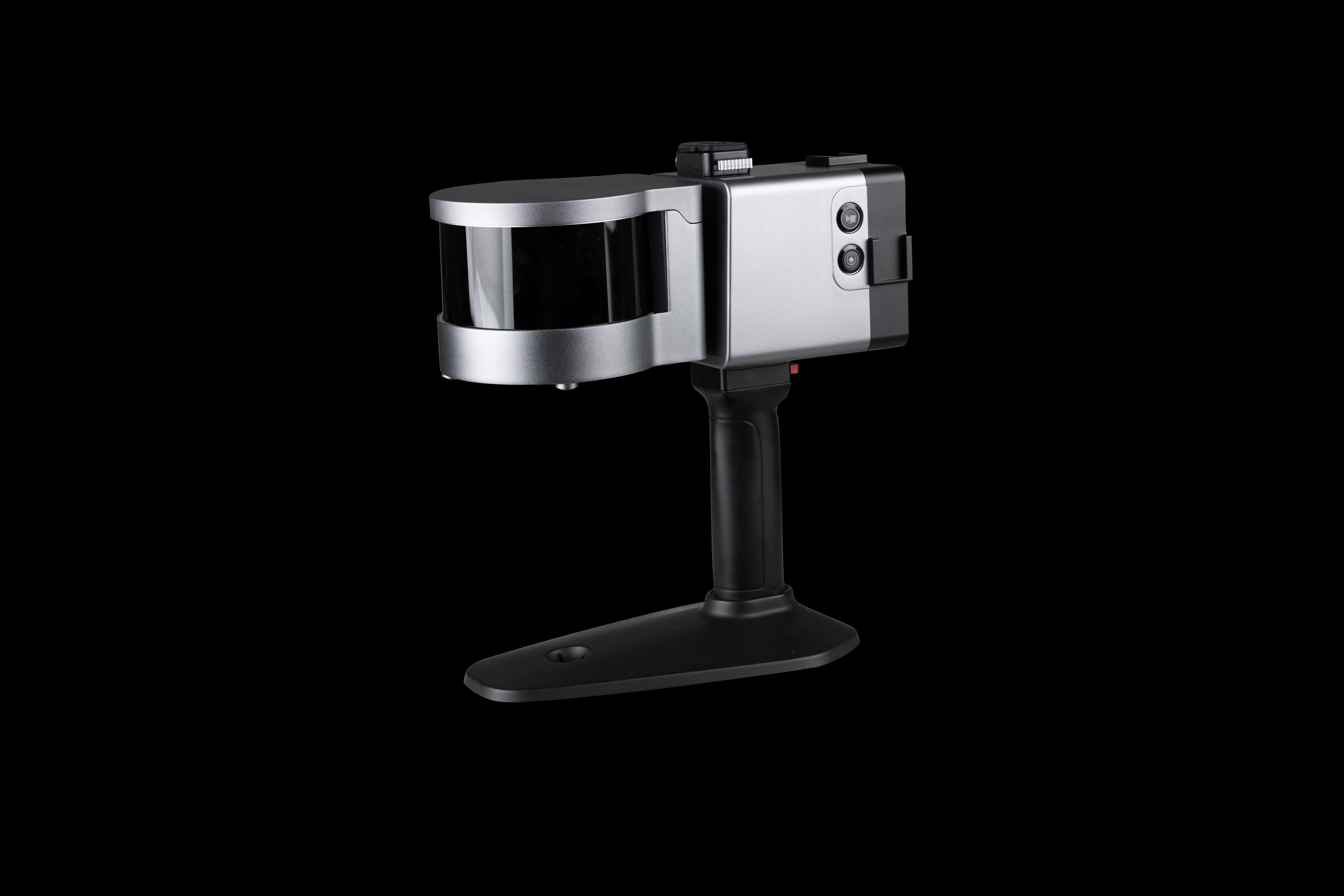
The LS300 Laser Scanning System uses SLAM technology (simultaneous localization and mapping), which is real-time positioning and mapping technology. It does not rely on GNSS positioning, and performs self positioning and incremental 3D mapping in unknown environments, including indoors and outdoors. Its lightweight design makes measurement work so easy. With synchronous data acquisition, simply walking around can complete the information data collection. ComNav Technology is committed to providing user-centered 3D laser mobile scanning measurement system product solutions, bringing users a better work experience.
The LS300 Laser Scanning System uses SLAM technology (simultaneous localization and mapping), which is real-time positioning and mapping technology. It does not rely on GNSS positioning, and performs self positioning and incremental 3D mapping in unknown environments, including indoors and outdoors. Its lightweight design makes measurement work so easy. With synchronous data acquisition, simply walking around can complete the information data collection. ComNav Technology is committed to providing user-centered 3D laser mobile scanning measurement system product solutions, bringing users a better work experience.

P8 Tablet High Precision Version
P8 Tablet High Precision Version
P8 Tablet High Precision Version (P8H) integrates a high precision GNSS module and antenna, along with an 8’’ sunlight-readable screen. It tracks all running and planned constellations, including GPS, BDS, GLONASS, GALILEO, QZSS, IRNSS and SBAS. Thus, it can deliver centimeter level accuracy. Compatible with common GIS software, it streamlines data collection. With 4G LTE, Wi-Fi, and Bluetooth 5.1, you can stay connected anywhere. Running on Android 12 with GMS certification, it offers a user-friendly interface. IP67 dustproof and waterproof, it ensures durability in harsh conditions. Simplify your fieldwork with the P8H.
P8 Tablet High Precision Version (P8H) integrates a high precision GNSS module and antenna, along with an 8’’ sunlight-readable screen. It tracks all running and planned constellations, including GPS, BDS, GLONASS, GALILEO, QZSS, IRNSS and SBAS. Thus, it can deliver centimeter level accuracy. Compatible with common GIS software, it streamlines data collection. With 4G LTE, Wi-Fi, and Bluetooth 5.1, you can stay connected anywhere. Running on Android 12 with GMS certification, it offers a user-friendly interface. IP67 dustproof and waterproof, it ensures durability in harsh conditions. Simplify your fieldwork with the P8H.
